Showing posts sorted by date for query bike bridge. Sort by relevance Show all posts

Monday, July 13, 2026

The missing element in urban infrastructure

If a bridge or tunnel is too narrow to accommodate bus and bike lanes, then a separate crossing should be built near it. Many bridges and highway tunnels don't have a provision for LRT or commuter rail, so then a rail crossing should be built near it.


https://jfdatalinks.blogspot.com/search?q=the+missing+element


Saturday, July 11, 2026

SkyBridge between NW and Surrey, BC

Unfortunately, due to inept regional transportation planning, the SkyBridge (1990) wasn't built with any extra width for bus lanes, bike lanes and sidewalks. Everything was just expected to be crammed onto the inadequate, 4 lane Pattullo_Bridge, which only had 1 narrow sidewalk. Back in the day, there was no concept of allowing additional future space for 2 wide truck lanes, 2 car lanes and 2 bus lanes on the Pattullo_Bridge_in_1937.

It was as if someone really didn't want to ever have any bus lanes on the Patullo Bridge and the SkyTrain Bridge.

https://en.wikipedia.org/wiki/SkyBridge_(TransLink)#Details 

Then, it was as if someone still didn't want to have any bus lanes on the Stalewasem_Bridge as well. Since the train isnt running 24hrs, a BRT crossing is important.

https://en.wikipedia.org/wiki/Stalewasen_Bridge This new bridge should have opened with at least 3 lanes each way, plus a bus lane each way. However, an 8 lane bridge with 2 wide emergency lanes and 2 wide shoulders would look too much like big city infrastructure. Big city scale infrastructure is difficult to establish in backwards BC. 


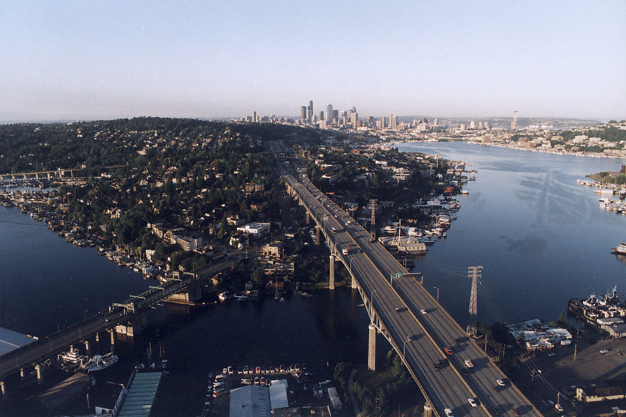
University Bridge (Seattle)

 https://en.wikipedia.org/wiki/University_Bridge_(Seattle) 

https://upload.wikimedia.org/wikipedia/commons/thumb/a/a2/University_Bridge_from_Ship_Canal_Bridge_-_01.jpg/960px-University_Bridge_from_Ship_Canal_Bridge_-_01.jpg
https://upload.wikimedia.org/wikipedia/commons/thumb/e/ee/Seattle_-_University_Bridge_and_U_District%2C_1963_%2849561206388%29.jpg/960px-Seattle_-_University_Bridge_and_U_District%2C_1963_%2849561206388%29.jpg


The University Bridge and the Burrard+Street+Bridge in V-BC used to have 6 lanes, but 2 lanes were removed for bikes. In both cases, a bike bridge should have been built next to them. Then, they both could still have 6 lanes.  


https://jfdatalinks.blogspot.com/search?q=Seattle

First Nation files court challenge against Burrard Inlet dredging project for oil tankers

 https://dailyhive.com/vancouver/burrard-inlet-second-narrows-oil-tanker-dredging-first-nation-court-challenge 

Decades ago, there should have already been a North Boundary Road bus and bike bridge beside the Iron-Bridge. Since the Iron Bridge wasn't widened to accommodate 2 express bus or 2 rapid bus lanes, a North Boundary Road bus and bike bridge would have been a huge improvement. 

Canada is on the same planet as Australia, but seems to be on a different world. Asia, Europe and the US just don't seem to have the same overlapping restrictions as Canada and especially, BC. 

Greater Vancouver should be on a similar city and port level as Brisbane, but the provincial backwater BC mindset keeps holding things back.

https://thehub.ca/2026/07/08/can-the-port-of-vancouver-handle-supertankers-a-closer-look-at-the-other-megaproject-inside-albertas-pipeline-proposal/

If Burrard Inlet isn't a suitable location for the tankers, then another location must be found. BC remains as a provincial backwater on the Pacific Rim and Canada has less than 1% of the worlds population. If it were possible, there are those in Canada who would like to just shut out the world and even shut Canada down.

Australia hasn't been able to do so much more than Canada simply because it doesn't have half of the year stuck in cold, crappy weather.


Friday, July 10, 2026

Tillikum Crossing or Bridge

https://en.wikipedia.org/wiki/Tilikum_Crossing , https://trimet.org/tilikum Its not just a great bus and bike bridge.

The Oregon version of the Tilikum is so much better than any BC version, but it doesn't have to be. BC should be able to build first rate stuff as well.

https://www.cntraveler.com/activities/portland/tilikum-crossing This fantastic MAX-LRT and streetcar bridge is great for Portland. However, such a wonderful bridge almost seems impossible for Vancouver & Victoria, or anywhere in backwards BC.

https://www.google.com/maps/place/Tilikum+Crossing+Bridge 


Of course the Victoria, BC (Saanich) version will be watered down. 

https://roninearthworks.ca/construction-news/tillicum-bridge

https://www2.gov.bc.ca/gov/content/transportation-projects/other-transportation-projects/tillicum-active-transportation-bridge-project 

https://victoriachamber.ca/government-local/new-trail-crossing-at-tillicum-will-ease-commute-time/

https://www.google.com/maps/search/transportation+bridge+across+Tillicum+Road/@48.4463043,-123.4007762,121m/data=!3m1!1e3!5m1!1e1?entry=ttu&g_ep=EgoyMDI2MDcwOC4wIKXMDSoASAFQAw%3D%3D 


A Burnaby and Richmond Tillicum Bus and Bike bridge would be a great transportation link.

https://www.google.com/maps/place/Tillicum+St,+Burnaby,+BC

There isn't even a South+Boundary+Rd bus and bike bridge in the works. Yet, the transportation planners claim that an efficient regional express and BRT network can be established. Its just another watered down BC joke. 


Victoria Bus and Bike Bridge in Brisbane

https://www.google.com/maps/place/Victoria+Bridge

Of course a bus and bike bridge makes sense in Brisbane & Calgary. That's why they aren't allowed in backwards Vancouver. 

https://www.reddit.com/r/brisbane/comments/1e98dkr/the_busway_victoria_bridge_living_up_to_its_name/ 

Vancouver is so lacking with bus and bike bridges. Its an ongoing part of the+missing+element in transportation planning in BC.

https://www.google.com/maps/place/Eleanor+Schonell+Bridge


https://www.google.com/maps/place/Kurilpa+Bridge

https://www.google.com/maps/place/The+Neville+Bonner+Bridge

https://www.google.com/maps/place/Goodwill+Bridge 

While Queensland is on the same planet as backwards BC, it might as well be on a different world. 

Saturday, June 27, 2026

How much will Vancouver change by 2036?

 https://www.youtube.com/watch?v=OJtotvMq2ls 

The Lion+Bridge will likely still not have an express bus and LRT tunnel near it. The+Iron+Bridge still might not have a proper BRT and LRT bridge next to it. The OSB and the KSB will likely not have a bus and bike bridge built beside them. There will still likely be no new Fraser Street Bridge for bikes and buses. No Boundary Road bridges to provide a direct link between the North Shore and Richmond for buses, trucks and bikes.

While the first 2 Skytrain lines will have 5 car trains, the stunted YVR-Canada Line will only have 2.5 car trains. Vancouver still might not permit any office tower to have a 40th floor, but might allow some residential towers to be on a Melbourne, Sydney, Brisbane & Toronto scale. 

However, BIG city thinking and planning in Vancouver has always been so difficult. Boston, SF and the City of Paris are ridiculously small cities like Vancouver with all 3 having a land area of less than 50 sq. mi. or 129.5 sq. km. Yet, Boston, SF and especially the City of Paris, have all been able to fit so much more into the same general space. That's because they aren't bound by anything like the inept and extreme Vancouver type restrictions. 


Wednesday, June 17, 2026

Ironworkers Memorial Second Narrows Crossing Collapse of 1958

 https://en.wikipedia.org/wiki/Ironworkers_Memorial_Second_Narrows_Crossing#Collapse 

After the collapse, there was a chance that the Iron_Bridge (IwB) could have been totally redesigned, but this is BC. Its very difficult in BC to design transportation infrastructure with significant future capacity. The Iron Bridge should have been built along the lines of the 12 lane Ship_Canal_Bridge (SCB) in Seattle. https://en.wikipedia.org/wiki/Ship_Canal_Bridge 

Unlike Seattle and Washington State, so much in BC is built to a provincial backwater standard. Thus, nothing on the scale of the SCB has ever been allowed in BC. https://pauldorpat.com/2014/05/17/seattle-now-then-the-ship-canal-bridge Sunce an LRT line wasn't possible for the SCB, it runs sort of parallel in a tunnel to the UW. Of course LRT to UBC is still an incomplete BC pipe dream.

The IwB should have had at least 8 lanes on an upper deck and 4 lanes on a lower deck for extra bus and truck lanes. There should have also been a provision for 2 LRT tracks on a lower deck, but that would be properly planning for the future. 

Unfortunately, the Vancouver Mind Virus (VMV) ruined the Burrard-Bridge. The Burrard_Street Bridge (BSB) opened with 6 lanes and a lower level provision for a double track streetcar crossing.

https://www.vancouverisawesome.com/local-news/5-things-you-probably-didnt-know-about-the-burrard-bridge-7129420 

Foolishly, because the city didn't want to build a parallel bike bridge, 2 lanes were removed from the BSB. This has made it very unlikely that the BSB will be able to have 2 bus lanes. No lower level streetcar crossing was ever built. Yet, a streetcar line on both side of False Creek could have been a nice thing to have up and running. Ironically, Vancouver was one of the first cities to get rid of its streetcars and will likely be one of the last to bring them back. The VMV is such a horrible thing, yet it officially doesn't exist. 


https://jfdatalinks.blogspot.com/search?q=Second+Narrows+Bridge

Monday, June 8, 2026

The Unusual transportation approaches used in Vancouver

 https://www.vancouverisawesome.com/history/5-of-a-kind-unusual-modes-of-transportation-used-or-nearly-used-in-vancouver-12388220 

Vancouver is such an unusual and backwards city with its inefficient and congestive approach towards transportation infrastructure.

Getting rid of the streetcars and interurban trams was utterly foolish! Fortunately, such MADNE$$ wasn't adopted in Melbourne, SF, Toronto, Boston, Philadelphia and New Orleans. 

Just because a no freeways mandate was chosen for Vancouver, the streets should have been kept wide enough for busses as well as other vehicles. 

https://movementyvr.ca/the-case-of-vancouvers-nine-missing-bus-lanes

Despite most of the Vancouver bridges being too narrow, some bridge lanes were removed, because the city wasn't interested in building parallel bike bridges. 

Since most of the bridges are so narrow, there isn't enough room for proper express bus lanes. Of course the city isn't interested in building parallel bus bridges next to the narrow bridges. 

Since Vancouver is supposed to be a major, properly functioning city in Western Canada, the city should have pressed the designers of the first 2 Skytrain lines to make sure that all of the 80 m stations could gradually be extended to 152.5 m, the same as the 500 foot long Montreal Metro stations and trains.

Unlike the first 2 Skytrain lines, the Canada Line was only designed to ultimately have 50 m stations and trains. A 2 billion dollar line to YVR could have been designed in such a way that would have allowed it to look and function like a proper big-city passenger train. 

A commuter train to the North Shore keeps taking a long time to be finalized.

https://northshoreconnects.ca/wp-content/uploads/2021/10/BIRT-Benefits-Assessment_Final.pdf

Think small and build backwards, or not at all. 

Friday, June 5, 2026

2 out of 3 is bad, but 4 bridges?

 Apparently, 2 of the 3 Skytrain bridges were never designed to also accommodate bikes.

https://www.google.ca/maps/place/North+Arm+Bridge/@49.2028331,-123.1189681,1005m/data=!3m1!1e3!4m14!1m7!3m6!1s0x548675f84f6c0721:0xbea3ccce242f45a8!2sMarpole+Bridge!8m2!3d49.1995219!4d-123.1268811!16zL20vMGZqMjYx!3m5!1s0x548675e222b072f3:0x1f4afd8a052e9fba!8m2!3d49.2030206!4d-123.1176091!16zL20vMGc1anZj?hl=en&entry=ttu&g_ep=EgoyMDI2MDYwMy4xIKXMDSoASAFQAw%3D%3D 

Unfortunately, all 3 Skytrain bridges weren't designed to have any express bus lanes, never mind any for a proper rapid bus network.

https://www.google.ca/maps/place/Middle+Arm+Bridge/@49.1956263,-123.1347899,597m/data=!3m1!1e3!4m6!3m5!1s0x548675e70cc6d0d1:0x203a51fa759dab7e!8m2!3d49.1957207!4d-123.1351442!16zL20vMGdna3px?hl=en&entry=ttu&g_ep=EgoyMDI2MDYwMy4xIKXMDSoASAFQAw%3D%3D   

In the 1980s, once it was revealed that Skytrain wouldn't be providing a 24 hour service, there wasn't a serious effort to convince the public of the importance of having a 24 hour regional express bus network. Transportation redundancy is difficult to grasp in backwards BC.

https://www.google.ca/maps/place/Marpole+Bridge/@49.2048651,-122.8949547,729m/data=!3m1!1e3!4m7!3m6!1s0x548675f84f6c0721:0xbea3ccce242f45a8!4b1!8m2!3d49.1995219!4d-123.1268811!16zL20vMGZqMjYx?hl=en&entry=ttu&g_ep=EgoyMDI2MDYwMy4xIKXMDSoASAFQAw%3D%3D 

All 3 of there's transportation bridges should have had enough future space for at least a 3rd track. Upon opening, each bridge should have had 2 bus lanes that also could be for emergency vehicles. Each bridge should have had 2 bike lanes and 2 sidewalks. 


https://www.google.ca/maps/place/Marpole+Bridge/@49.1996678,-123.1276435,848m/data=!3m1!1e3!4m6!3m5!1s0x548675f84f6c0721:0xbea3ccce242f45a8!8m2!3d49.1995219!4d-123.1268811!16zL20vMGZqMjYx?hl=en&entry=ttu&g_ep=EgoyMDI2MDYwMy4xIKXMDSoASAFQAw%3D%3D This was allowed to fall apart and eventually catch fire. It was never doubletracked and the interurban trams were phased out by the 1950s. Yet, most of the highways and general road system in SW BC cities are just 2 lanes each way. It was as if there was no need to have a 3rd lane for trucks and a 4th or 5th lane for buses & HOVs. 

https://stevestonheritage.ca/2024/06/21/marpole-cp-rail-bridge

https://jfdatalinks.blogspot.com/search?q=Oak+Street+Bridge

The transportation infrastructure was set up for congestion, right from the start. Having a short Skytrain & small stations might have made economic sense in its initial phase. However, there was a failure to not design it to eventually become a proper big-city size train with much longer stations.


https://jfdatalinks.blogspot.com/search?q=Stubborn+BC

Friday, May 22, 2026

Cambie Street Bridge seismic upgrade

 https://dailyhive.com/vancouver/cambie-street-bridge-seismic-upgrade-federal-funding 

Unless the west sidewalk is widened, or a parallel bike bridge is constructed, the C bridge will still be missing a lane & remain with 5, instead of 6 when it opened in the 1980s.

Friday, May 15, 2026

Granville Bridge death was preventable, advocates say

 https://vancouver.citynews.ca/2026/05/14/granville-bridge-death-was-preventable-say-advocates/ 

While the Granville+Bridge needs to have a higher fence like the Burrard+Bridge, there is another remaining pending danger. 

https://vancouversun.com/news/iio-investigates-womans-death-after-9-hour-incident-on-granville-street-bridge 

There is no central safety barrier to prevent head-on collisions. Whether a person becomes disoriented, or actually wants to crash into traffic from the opposite direction, there is no traffic divider.

https://www.ctvnews.ca/vancouver/article/barrier-needed-on-vancouver-bridge-after-another-suicide-death-advocates-say/

The sidewalks could have been made a little wider in a way that there still could have been enough space for a traffic divider. 

https://www.reddit.com/r/vancouver/comments/1td85mt/iio_investigates_womans_death_after_ninehour/ 


https://jfdatalinks.blogspot.com/search?q=Granville+Bridge Was 8 lanes, now 6, but with 2 bike lanes and wider sidewalks.

https://jfdatalinks.blogspot.com/search?q=Burrard+Bridge Was 6 lanes, now 4, but with 2 bike lanes & already good sidewalks. 

Unfortunately, both bridges have no middle safety barrier to prevent head-on collisions, despite their recent modifications. 


The Pattullo+Bridge was too narrow to ever have a traffic divider. Fortunately, its 4 lane replacement does have a central divider. 

https://jfdatalinks.blogspot.com/search?q=Knight+Street+Bridge Only 4 lanes in the middle, but has a traffic safety barrier. The KSB really needs a bus and bike bridge next to it.

https://jfdatalinks.blogspot.com/search?q=Oak+Street+Bridge A traffic divider was eventually installed, but the narrow bridge was never designed to have 2 emergency lanes, or 2 wide shoulders. There especially was no consideration to have 2 bus lanes on the OSB. Since there is no 24 hour train service to the airport, there should be a parallel bus and bike bridge. 

https://jfdatalinks.blogspot.com/search?q=Arthur+Laing+Bridge While it does have a traffic divider, there are no wide emergency lanes or wide shoulders. There isn't even enough space for 2 bus lanes. Thus, a bus and bike bridge really should be built next to it.

Sunday, May 3, 2026

The Cambie Bridge used to have 6 lanes when is opened in the 1980s.

 https://www.youtube.com/watch?v=n2m4n1tUYVM This is heading northbound and shows the proper wide sidewalk that's on the east side of the bridge.

For some reason the sidewalk on the west side of the bridge was made too narrow. Had the sidewalk been as wide as the one on the east side of the bridge, the Vancouver planning department wouldn't have likely reduced a lane. Of course if the city would ever build a proper bike bridge beside the Cambie Bridge, then perhaps the 6th lane might be reactivated. 

A 6 lane Cambie bridge is better than a 5 lane version, or a former 6 lane Burrard Bridge reduced to 4. If both bridges had bike bridges next to them, then 2 lanes of each original 6 lane bridge could have been for busses. However, that goes against the congestive planning agenda that is backwards Vancouver. 

The late 1950s, 6 lane Iron Bridge should have had 2 wide emergency lanes and 2 wide shoulders. Then, the Iron Bridge could have been gradually modified to have 4 lanes each way, plus a bus lane each way. However, having a 10 lane bridge is what a big city would do. Unfortunately, Vancouver city planning has become so engrossed with perpetuating a small city agenda over the decades. 

When most of the regional bridges were built, there was no concept or interest in having them wide enough for bus lanes and wide emergency lanes and wide shoulders. Congestive transportation planning or stunted infrastructure, is one of the best ways in demonstrating a local reluctance to properly build big for the future. Who knows where all the money went over the decades, because it doesn't look like enough of it went towards building wider bridges and having longer trains and stations. 

https://vancouver.citynews.ca/2026/05/02/expo-86-40-years-later-the-memories-live-on

Just mostly more stumps or some real Towers in Vancouver?

 https://cityhallwatch.wordpress.com/2026/05/02/opinion-the-yiyby-critique-bilsker 

https://www.skyscrapercenter.com/building/the-stack/35667 Only 38 floors.

https://en.wikipedia.org/wiki/Royal_Centre_(Vancouver) Just 37 stories. 

https://en.wikipedia.org/wiki/Columbia_Center Seattle's tallest has 76 stories. 

https://en.wikipedia.org/wiki/Ship_Canal_Bridge 12 lanes consisting of three 4 lane sections.

Mostly short buildings, short trains and narrow bridges are all part of the imposed symbolism to keep Vancouver small and backwards. 

While Seattle had its first 50 story office tower in 1969 and Calgary in 1984, stubborn Vancouver still won't permit any office tower to have a 40th floor. 

A 30-35 story office tower would be impressive if it was in Victoria, Kelowna, Kamloops and Prince George. However, what's impressive in backwards Vancouver & backwater BC isn't impressive in Alberta, Ontario, Quebec, Washington State, Victoria State, NSW, Queensland & WA... 

Stumpy buildings, short trains and narrow bridges makes for the Vancouver trifecta of B$ city planning.

https://www.google.com/maps/place/Fort+McMurray,+AB 10 lanes. Only the TCH bridge between Surrey and Coquitlam in BC has been allowed to have as many lanes as this. Some people still wish that everything could have remained funneled into just 2 or 3 lanes each way.

https://www.google.com/maps/place/Quesnell+Bridge 8 lanes in Edmonton. 

https://www.google.com/maps/place/Hwy.+2A+Red+Deer+City+Centre+Bridge 6 lanes.

https://www.google.com/maps/place/Calgary,+AB 10 lanes.

https://www.google.com/maps/place/Calgary,+AB 8 lanes.

https://www.google.com/maps/place/Lethbridge,+AB It has 6 lanes. Being from backwards Vancouver, its amazing that this 6 lane bridge wasn't funneled into just 2 lanes each way. That's what happened with the Knight_Street_Bridge.

https://www.google.com/maps/place/Hwy.+2A+Red+Deer+City+Centre+Bridge As a 5 lane TCH crossing, it only has 1 less lane than the 6 lane Iron Bridge in congested, backwards Vancouver. Since Alberta isn't under anything like the imposed BC restrictions, this crossing will likely be eventually upgraded to have 6 lanes, plus 2 wide emergency lanes & 2 wide shoulders that could provide 4 lanes each way, some day. 

https://www.google.com/maps/place/Winnipeg,+MB A TCH bridge with 9 lanes, because no one from narrow-minded Vancouver was able to get them to narrow this crossing. The TCH Iron Bridge in Vancouver just has 6 lanes. No bus and LRT bridge has ever been built next to it, so far.

https://www.google.com/maps/place/Winnipeg,+MB A 6 lane crossing. 

As of 2026, congested Vancouver only allows 2 bridges to have 6 lanes. A total of 5 lanes were removed from 3 Vancouver bridges. Had Vancouver built a series of proper bus and bike bridges, no lanes would have been removed. 

Despite NW trying to be one of the smallest cities in BC, Surrey is set to become the biggest city in BC. Fortunately, small NW & backwards Vancouver can't stop that from happening. However, narrowminded NW was able to force a narrower new bridge to Surrey. 

This bridge-replacement is one of the best examples of BC bottleneck-chokepoint planning today.

McBride_Blvd. and Royal_Ave_in_New_Westminster are mostly 4 lane corridors.

King_George_Boulevard and Scott_Road both are at least 4 lanes wide. One might think that the new bridge should have had 10 lanes, or at least 8 lanes, because two 4 lane boulevards, a 4 lane avenue and a 4 lane road, are all funneled into a bridge that opened with only 2 lanes each way. The old bridge that it replaced was also a 4 lane crossing. A congestive approach to transportation planning is the name of the game in backwards B.C.

https://upload.wikimedia.org/wikipedia/commons/thumb/d/d7/Stalewasem_Bridge_%282026-03%29.jpg/960px-Stalewasem_Bridge_%282026-03%29.jpg 
At the very least, this new 4 lane bridge should have had enough room for 2 wide emergency lanes, 2 wide shoulders and especially, 2 bus lanes. There should have been a provision for a lower deck for LRT, bus and truck lanes, given that this is supposed to be a seaport region.

The narrowmindedness planning by Greater Vancouver to still have mostly narrow crossings, has made it very difficult to implement a proper regional express bus network, let alone BRT. 

The first 2 Skytrain lines only have station lengths that can barely accommodate the new 5 car trains. The YVR Line or the C Line, has stations than can only accommodate a 2.5 car train, some day. Given that the Skytrain network is a multibillion dollar transit system, all of the stations should have been designed to gradually accommodate 8-10 car trains, but that's what a proper big city would do. 

https://vancouver.citynews.ca/2026/05/02/expo-86-40-years-later-the-memories-live-on 

Four decades later and Greater Vancouver remains so far behind with the scale of its infrastructure.

Wednesday, April 22, 2026

Temporary stal̕É™w̓asÉ™m Bridge closure will impact all traffic this weekend for construction

 https://dailyhive.com/vancouver/bridge-temporary-closure-surrey-new-westminster 

Lets open a bridge without 2 wide emergency lanes or 2 wide shoulders. Especially make sure that it didn't open with enough space for 2 bus lanes and 2 HOV lanes. Of course don't design the Bridge to have a potential lower deck for trucks and trains. Its an instant classic BC bottleneck chokepoint! 

https://www.pattullobridgereplacement.ca/about/projectoverview Just like the SkyBridge, apparently, there was no need to open it with 2 bus lanes, despite the train not running 24/7.

Unfortunately, the Bridges_over_the_Fraser_River in the BC Lower_Mainland just weren't designed to have proper bus lanes. Its so strange that the narrow SkyBridge was_for_SkyTrain only. 

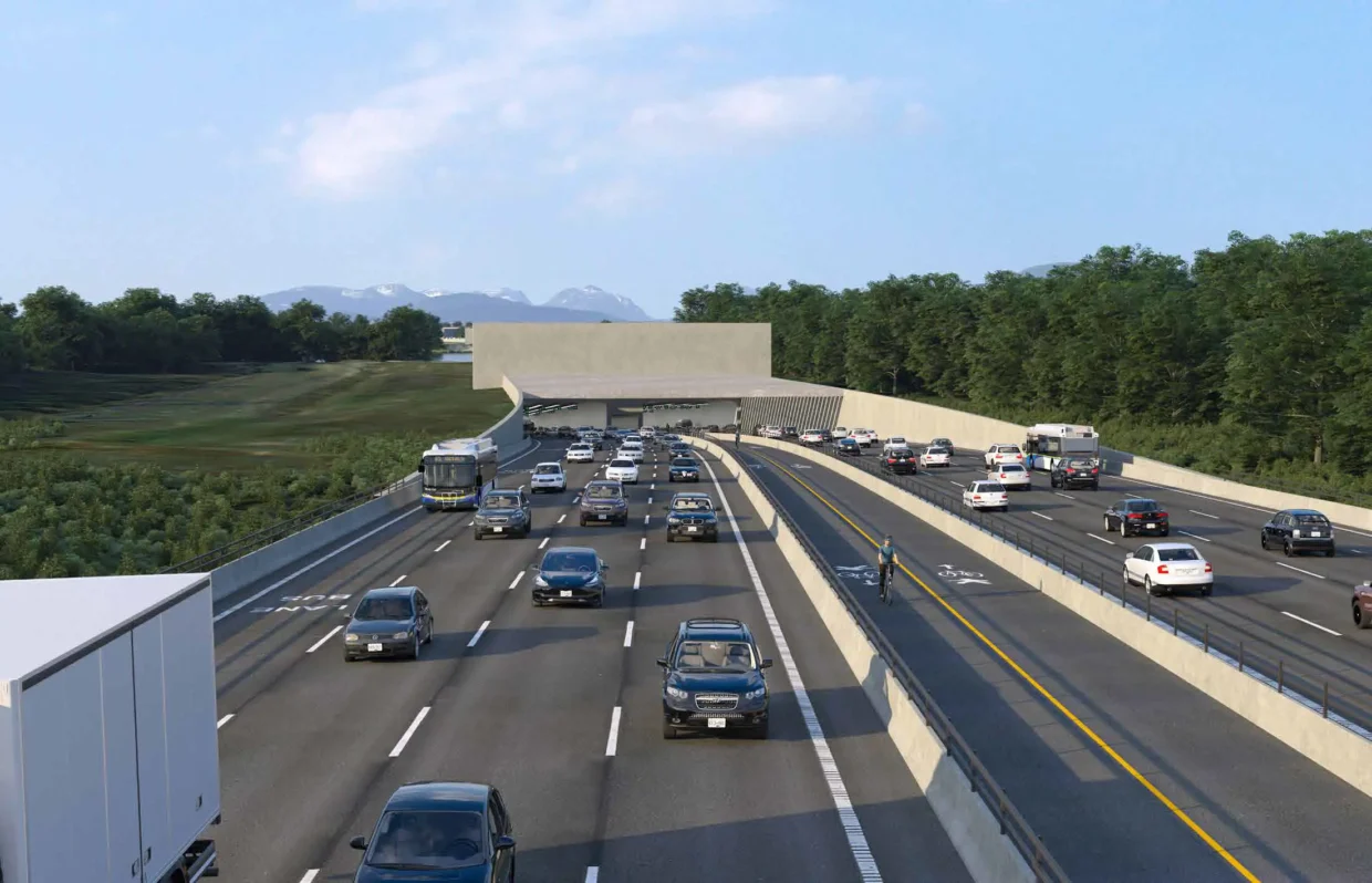
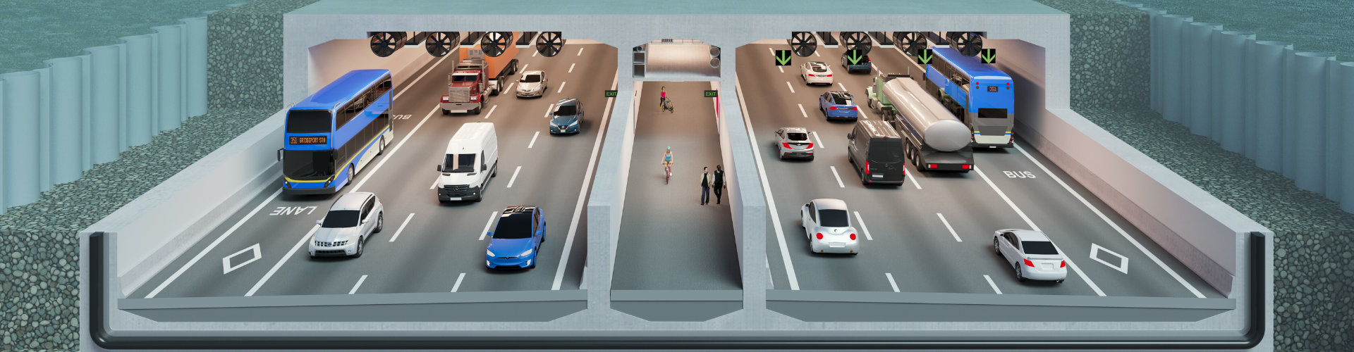
Just like the new tunnel between Richmond and delta, there is no provision for 2 train tracks. While there are 2 bus lanes, there won't be any exclusive HOV lanes. Eventually, there will have to be a proper train and rapid bus bridge or another tunnel beside it. 

https://www.highway99tunnel.ca/project-overview-frt "The Fraser River Tunnel Project includes a new, eight-lane immersed tube tunnel that will replace the existing George Massey Tunnel on Highway 99. The new tunnel will have three vehicle lanes and a dedicated transit lane in each direction, with a separated active transportation corridor for cyclists and pedestrians." 

Given that this is supposed to be a major port region, a train and rapid bus crossing needs to eventually be there. A train connecting YVR to the Tsawwassen Ferry terminal and 2 rapid bus lanes. Then the main tunnel could still provide 3 general lanes each way, plus a HOV lane each way. https://www.infrastructurebc.com/project/fraser-river-tunnel-project/  

Unfortunately, proper big city size infrastructure is a difficult thing to achieve in backwards BC. Since the decision was made to not have a rail component in the new highway99tunnel, the middle 2 bike lanes should have been wide enough to eventually become 2 rapid bus lanes. Then a new bridge or parallel tunnel could have a YVR to ferry terminal train, plus 2 truck lanes, 2 bike lanes an 2 sidewalks. 

This is what a proper big regional port crossing should be like, but for backwater BC, its a different set of priorities. 

Wednesday, April 8, 2026

TransLink to expand bus service on 42 routes across Metro Vancouver this spring

 https://dailyhive.com/vancouver/translink-metro-vancouver-bus-route-changes-spring-2026 

While more frequent bus service is great, unless there is a proper regional bus+and+bike+bridge network, the transit system will still be lacking in its efficiency.

Sunday, April 5, 2026

Vancouverites have some of the longest commutes in Canada

 https://dailyhive.com/vancouver/vancouver-longest-commute-canada 

With most of the regional bridges being too narrow, there isn't enough space for proper express bus+lanes or BRT lanes. Plus, the first 2 Skytrain lines only have the potential to accommodate 5 car trains. The Canada (Embarrassment) Line wasn't designed to eventually have 5 car trains, only 2.5 car trains. Narrow bridges and short trains are all part of the symbolic reluctance towards having proper big city size infrastructure.


https://jfdatalinks.blogspot.com/search?q=bus+and+bike+bridge

Thursday, April 2, 2026

Major upgrades to busy Queensborough Bridge will close lanes until 2027

https://dailyhive.com/vancouver/queensborough-bridge-upgrades-lane-closures-new-westminster-richmond 

When the Queensborough_Bridge opened in 1960, there wasn't any serious consideration for future capacity. The QB should have had 2 wide shoulders and 2 wide emergency lanes. Then, by the 1980s 2 bus lanes could have been opened. Then, by around 2000 the QB could have had 3 lanes each way, plus 1 bus lane each way.

https://vancouver.citynews.ca/2026/04/02/construction-to-close-queensborough-bridge-lanes-overnight-until-2027

https://www2.gov.bc.ca/gov/content/transportation-projects/other-transportation-projects/queensboroughbridge

https://en.wikipedia.org/wiki/Queensborough_Bridge Unfortunatly in 2026, the QB remains as a 4 lane funnel. Just 2 lanes each way as its another classic BC bottleneck-chokepoint, by design. There is enough space east of the bridge for a new northbound bridge to be built. 

New_Westminster has always been a small city, because it never absorbed what would become the Tri-Cities. Thus, a narrow QB fits in with such a little provincial backwater. However, as part of the BC Lower_Mainland its part of a region with over 3 million people. This puts NW in the position of being a regional hub city. 

https://604now.com/queensborough-bridge-upgrades-richmond-new-westminster-2026-2027/

https://dailyhive.com/vancouver/queensborough-bridge-upgrades-new-westminster-richmond

https://www.patrickjohnstone.ca/2013/07/alas-queensborough-bridge-works.html

http://archives.newwestcity.ca/permalink/24422 , http://archives.newwestcity.ca/permalink/99415/  

https://en.wikipedia.org/wiki/Queensborough,_New_Westminster , https://www.newwestcity.ca/database/rte/122554-QB.PDF

Bike+bridges aren't a problem in many Australian cities and around the world. However, as usual, its more difficult to get such things done in backwards BC.

https://www.newwestcity.ca/database/files/library/Q2Q_Bridge_Brochure_2015_02_02.pdf  

https://www.patrickjohnstone.ca/2013/07/connecting-qb-to-quay.html There should have been a proper bike and foot bridge between Queensborough and downtown NW, decades ago. 

https://www.newwestcity.ca/planning-building-and-development/projects-on-the-go/articles/3475.php


 https://jfdatalinks.blogspot.com/search?q=Queensborough+Bridge

The Pattullo Bridge replacement, so far

 https://www.pattullobridgereplacement.ca/construction/bridge-opening/ 

There are still months of finishing touches.

https://www.pattullobridgereplacement.ca/construction/current-works/ 

Over the course of the year, many more people will start to realize that despite there being adequate bike lanes, there are no bus lanes, no wide shoulders and especially no emergency lanes. Its currently still too narrow for all of that.

https://www.reddit.com/r/SurreyBC/comments/1omufv6/the_new_pattullo_bridge_will_gradually_open_to/  

In fact, the bridge was deliberately designed to be so narrow that there is only enough future deck space for either 2 bus lanes or 2 emergency lanes, but not both. For now, its just another 4 lane BC funnel.

https://www.google.com/maps/place/New+Westminster,+BC 

No lower deck for a potential truck connection between Surrey and Front Street and especially, no lower deck for a future LRT crossing.

https://www.vancouverisawesome.com/highlights/pattullo-bridge-renamed-stalwasm-set-to-open-soon-11595501

It seems that whenever its possible, a 4 lane BC bottleneck-chokepoint is all that's necessary.

https://www.reddit.com/r/SurreyBC/comments/1rb4nmd/bus_connect_surrey_and_coquitlam/ 

It really would be a good idea to eventually have a couple of bus lanes on that bridge, especially since the Skytrain doesn't run 24 hours a day.

https://www.google.com/maps/place/New+Westminster,+BC/@49.2037496,-122.8791442,674m/data=!3m1!1e3!4m6!3m5!1s0x5485d8753ddb5097:0xeca8e918f64dfeee!8m2!3d49.2057179!4d-122.910956!16zL20vMDF2cXEx!5m1!1e1?entry=ttu&g_ep=EgoyMDI2MDMzMS4wIKXMDSoASAFQAw%3D%3D 

Its still amazing how the SkyBridge (1990) was never built with 2 bus lanes, 2 bike lanes and 2 sidewalks. Such is the narrowminded planning methodology that is backwards BC.  

https://en.wikipedia.org/wiki/SkyBridge_(TransLink)#Details   


https://jfdatalinks.blogspot.com/search?q=Pattullo+Bridge+replacement 

https://jfdatalinks.blogspot.com/search?q=Queensborough+Bridge 

https://jfdatalinks.blogspot.com/search?q=SkyBridge

Tuesday, March 31, 2026

List of crossings of the Fraser River on the South Arm

 https://en.wikipedia.org/wiki/List_of_crossings_of_the_Fraser_River#South_Arm  

The Alex_Fraser_Bridge should have opened with 8 lanes with enough width to eventually have 10 lanes. Plus, 2 wide bike lanes and 2 footpaths. A wide emergency lane or wide shoulder that could have eventually become 2 bus lanes.

https://en.wikipedia.org/wiki/Alex_Fraser_Bridge So, instead of an ultimate design of 10 lanes with 2 emergency lanes and a provision for a lower deck, everything was squeezed into only 2 lanes each way. There wasn't even enough planning logic to have a wide shoulder or wide emergency lane on each side in the first phase of construction. It was an instant classic 4 lane BC bottleneck-chokepoint. 

Fortunately, there was at least a provision for it to eventually accommodate 6 lanes and ultimately, a 7th lane was squeezed in. Its still a far cry from being 12 lanes wide or having a lower deck. 

The British_Columbia_Highway_91 should have been properly been built as an effective bypass to the joke that is the 4 lane George_Massey_Tunnel chokepoint. The H-91 and the Alex_Fraser_Bridge should have had 4 lanes each way, plus a bus lane each way. Especially, since there is no train along that corridor and there still isn't enough government interest to have a train next to the George_Massey_Tunnel-Replacement. While the new tunnel will have a bus lane each way, there is no provision for a train tunnel or bridge. This isn't just another case of BC planning shortsightedness, its indicative of the BC Mind Virus. 

The BCMV isn't supposed to be real, but something like it always seems to show up whenever there is a chance to build some proper big city size infrastructure.