Showing posts sorted by date for query HOV Lane. Sort by relevance Show all posts

Monday, April 27, 2026

Old Pattullo Bridge and its Still Narrow Replacement

 https://www.youtube.com/watch?v=8_mNfn4zjcI 

Even in the 1930s there should have been some type of a big city vision, but with NW being so small and Surrey being so out of the way, this part of BC was on the urban periphery. Apparently, there was no concept of an emergency lane on the Pattullo Bridge. Still, in addition to the 2 narrow lanes each way, there should have been 2 lane for horses and wagons. Then, by the 1950s the PB could have had 3 wide lanes each way, pulse a strong traffic divider. Instead, the narrow PB was stuck with only two lanes each way, no safety divider and only 1 narrow sidewalk.

For most of its history, NW just saw it self as a provincial backwater. The lack of a big city vision in the early 1900s meant that it never bothered to absorb what would become the Tri-Cities. For most of its history, Surrey never considered that it could eventually become the largest city in BC. Of course now that has changed.

Despite being so small, NW has become a Metro Vancouver regional transit hub, because of the New_Westminster_station

Scott_Road_station is a transit hub for the South_Westminster area.

Surrey and NW really should have had a proper big city size bridge.

This is how the new road configuration could have gone for what should have been a 10 lane bridge, not another 4 lane BC joke. Even if it can eventually have 6 lanes, there is no provision for a lower deck for trains and busses.

This shows how existing key roads could have linked into a 10 lane bridge, all without having to widen the surrounding roads. Thus, no need for any major land expropriation.

2 lanes from Royal Avenue onto the new bridge and 2 lanes from the bridge onto Royal Avenue in New+Westminster.   

One lane onto and one lane off linking the bridge to the South_Fraser_Perimeter_Road in Surrey.

2 lanes onto McBride boulevard and 2 lanes onto the bridge from McBride in New+Westminster.  

From Columbia_Street_in New_Westminster, 1 lane onto the bridge, as well as 1 lane off the bridge

2 lanes from King_George_Boulevard onto the new bridge and 2 lanes from the bridge onto KGB in Surrey

2 lanes from Scott Road onto the new bridge and 2 lanes from the bridge onto Scott_Rd in Surrey.  

Things weren't properly explained to the public as to how important a wide big city bridge could have been possible and without having to widen the roads connecting to it.

Unfortunately, all of this is being funneled into just 2 lanes each way. Its as if someone symbolically wanted the new bridge to open without any bus and HOV lanes. That's how BC bottleneck and chokepoint planning works. 


https://en.wikipedia.org/wiki/Metro_Vancouver_Regional_District  

https://en.wikipedia.org/wiki/Fraser_Valley

Some day, the BC Lower_Mainland should be planned and developed to function more like a proper big urban area. 

Wednesday, April 22, 2026

Temporary stal̕əw̓asəm Bridge closure will impact all traffic this weekend for construction

 https://dailyhive.com/vancouver/bridge-temporary-closure-surrey-new-westminster 

Lets open a bridge without 2 wide emergency lanes or 2 wide shoulders. Especially make sure that it didn't open with enough space for 2 bus lanes and 2 HOV lanes. Of course don't design the Bridge to have a potential lower deck for trucks and trains. Its an instant classic BC bottleneck chokepoint! 

https://www.pattullobridgereplacement.ca/about/projectoverview Just like the SkyBridge, apparently, there was no need to open it with 2 bus lanes, despite the train not running 24/7.

Unfortunately, the Bridges_over_the_Fraser_River in the BC Lower_Mainland just weren't designed to have proper bus lanes. Its so strange that the narrow SkyBridge was_for_SkyTrain only. 

Just like the new tunnel between Richmond and delta, there is no provision for 2 train tracks. While there are 2 bus lanes, there won't be any exclusive HOV lanes. Eventually, there will have to be a proper train and rapid bus bridge or another tunnel beside it. 

https://www.highway99tunnel.ca/project-overview-frt "The Fraser River Tunnel Project includes a new, eight-lane immersed tube tunnel that will replace the existing George Massey Tunnel on Highway 99. The new tunnel will have three vehicle lanes and a dedicated transit lane in each direction, with a separated active transportation corridor for cyclists and pedestrians." 

Given that this is supposed to be a major port region, a train and rapid bus crossing needs to eventually be there. A train connecting YVR to the Tsawwassen Ferry terminal and 2 rapid bus lanes. Then the main tunnel could still provide 3 general lanes each way, plus a HOV lane each way. https://www.infrastructurebc.com/project/fraser-river-tunnel-project/  

Unfortunately, proper big city size infrastructure is a difficult thing to achieve in backwards BC. Since the decision was made to not have a rail component in the new highway99tunnel, the middle 2 bike lanes should have been wide enough to eventually become 2 rapid bus lanes. Then a new bridge or parallel tunnel could have a YVR to ferry terminal train, plus 2 truck lanes, 2 bike lanes an 2 sidewalks. 

This is what a proper big regional port crossing should be like, but for backwater BC, its a different set of priorities. 

Sunday, March 29, 2026

YVR-Canada Line and REM Train

 https://www.youtube.com/watch?v=a1ouk0VifwM&t=42s Even if the YVR-Canada Line had to initially be built as a symbolically small city train, urban transportation infrastructure can be designed in ways that can double or even triple capacity to meet future demand. Unfortunately, its very difficult to build anything in BC with significant future capacity in mind.

Ultimately, the YVR-Canada Line should have had level station clearances to eventually be able to accommodate 10 car trains. Unfortunately, in typical backwards BC planning the stations weren't even designed with enough level clearance to accommodate 5 car trains. The joke that is the Canada Line only has a level station clearance of 50m to eventually accommodate just a 2.5 car train. 

Most other cities actually build long stations to accommodate long trains right in the first place. Or, at least allow for enough level clearance so that the stations can eventually be doubled or tripled in length. 

The YVR-Canada Line should have started with the Vancouver & Richmond segment, then the Vancouver and Horseshoe+Bay+ferry+terminal segment. Then finally, the YVR to Delta and the Tsawwassen+ferry+terminal

The SkyTrain Stations in Greater Vancouver https://www.youtube.com/watch?v=6Qg78Bmf1fk

Unfortunately, proper big city transportation planning is very difficult to achieve in backwards BC. So much is watered down in Vancouver.


Montreal’s Biggest REM Expansion Yet https://www.youtube.com/watch?v=4G1oeIAfxDU&t=106s 

The Montreal REM https://www.youtube.com/watch?v=g9O6RzsXIqQ 

While the REM was designed to help the Metro, it should have the capability to be gradually expanded. Eventually, REM trains should be lengthened from 4 car trains to 6 and even 8 car trains. 

In contrast, every Skytrain line should have been designed with enough level future station clearance to eventually accommodate a train as long as a 152.5 (500 ft.) long Montreal Metro train. The first 2 Skytrain lines have 80m stations and the joke that is the Canada Line only has 50m stations. 

While the first 2 lines can accommodate 5 car trains, the C Line wasn't designed to accommodate 5 car trains. Just 2.5 car trains, someday. 

Despite there being such a symbolic push for Vancouver to keep having short trains, narrow bridges and stumpy buildings, things are gradually changing in backwards BC. The Vancouver or BC Mind Virus should have been challenged decades ago, but too many loud people wanted to perpetuate the, KEEP THINGS SMALL AND INDEQUATE agenda.

Given how most of the bridges in Greater Vancouver are so narrow, there isn't enough room for proper bus and HOV lanes, or even wide emergency lanes. One would think that at least the trains & stations would have been designed to eventually be doubled or tripled in length. But that would go against the mutigenerational congestive planning agenda. That's why there still is only a 3 lane LGB when there should have been at least a parallel bus, HOV and train tunnel. The Pattullo+Bridge replacement didn't open with 2 bus and 2 HOV lanes, not even wide shoulders or emergency lanes. NW really likes the congestive planning approach. Of course the new tunnel between Richmond and Delta won't have an additional provision for a train tube. This will also help to perpetuate the congestive transportation mandate. 

Fortunately, Selective_door_operation technology can eventually allow more sensible transportation planners to enable longer trains. 

https://en.wikipedia.org/wiki/Selective_door_operation#International_variations , https://www.youtube.com/watch?v=YdH5d1ZthmM 

This means that a 5 car Skytrain (85m) could eventually become a 7 car train, despite the 80m stations. 

https://en.wikipedia.org/wiki/SkyTrain_(Vancouver)_rolling_stock#Alstom_Mark_V Thus, an 80m train can become a 117m train.

A two car and 2.5 car (50m) train on the multibillion dollar Canada Line is so absurd and inept! With some slight station modifications, there could be a potential to eventually accommodate three, 20m cars at such short platforms. Then, once 3 car trains could become possible, its just a matter of having an extra 20m car at both ends of each train. A 5 car train of 100m is so much better than a 50m joke of a train. 

https://en.wikipedia.org/wiki/SkyTrain_(Vancouver)#Alstom_Mark_V_fleet 


https://jfdatalinks.blogspot.com/search?q=SkyTrain-Canada+Line

https://jfdatalinks.blogspot.com/search?q=REM

Monday, March 9, 2026

The narrow Pattullo Bridge Replacement

https://www.pattullobridgereplacement.ca/construction/current-works Its a nice 4 lane bottleneck choakpoint. There should have been a provision for a lower deck for bus lanes, HOV lanes and LRT, but that would help to alleviate some transportation congestion.

It wasn't designed with that much future capacity in mind, just like the absurd Canada+Line. The SkyTrain-Canada+Line is still only running 2 car trains. The New stal̕əw̓asəm Bridge is only 2 lanes each way. This is congestive urban planning in BC at its best. Narrow bridges and short trains are some of the best ways to symbolically demonstrate a reluctance to accommodate future growth capacity. 

People aren't suppose to wonder where all the money went over the past several generations, because it seems that not enough funds have gone towards proper big city infrastructure.


Repairs on the Ironworkers Bridge

 https://dailyhive.com/vancouver/ironworkers-memorial-bridge-lane-closures-vancouver 

Unfortunatly, when this bridge was designed, there was no serious consideration to have 2 wide emergency lanes and 2 wide shoulders. Then, the Iron Bridge could have gradually been adapted to accommodate 2 bus lanes and 2 HOV lanes. At the very least, a bus, HOV and commuter train bridge should have been built next to the inadequate Iron Bridge back in the 20th century.

https://en.wikipedia.org/wiki/Ironworkers_Memorial_Second_Narrows_Crossing Opened August 25, 1960  

https://en.wikipedia.org/wiki/Granville_Street_Bridge Opened February 4, 1954 https://upload.wikimedia.org/wikipedia/commons/thumb/0/0c/View_of_downtown_Vancouver_from_the_Granville_Street_Bridge.JPG/960px-View_of_downtown_Vancouver_from_the_Granville_Street_Bridge.JPG

https://en.wikipedia.org/wiki/Oak_Street_Bridge Opened June 29, 1957 https://upload.wikimedia.org/wikipedia/commons/thumb/5/5f/Oak_Street_Bridge.jpg/960px-Oak_Street_Bridge.jpg  

https://en.wikipedia.org/wiki/Knight_Street_Bridge Opened January 15, 1974 https://upload.wikimedia.org/wikipedia/commons/f/f0/Knight_Street_Bridge.jpg

https://en.wikipedia.org/wiki/Arthur_Laing_Bridge Opened 27 August 1975 

https://evelazarus.com/third-crossing-here-we-go-again Somehow, Vancouver just never got around to building a bus and train tunnel or bridge in between the Lion Bridge and the Iron Bridge. Since Skytrain doesn't run 24 hours, there needs to be 24 hour bus lanes. 

https://www.pc.gc.ca/apps/dfhd/page_nhs_eng.aspx?id=11273 Some day, the Lion Bridge could become a nice bus and bike bridge, if a highway tunnel could ever be built under the park and beside the LGB. 

Unfortunately, the Vancouver Mind Virus (VMV) keeps getting in the way of progress. Just look at how short the Canada Line trains are.

Thursday, March 5, 2026

Why the Widest Freeway on Earth still Made Traffic Worse in Houston

 https://www.youtube.com/watch?v=vMwKgT4ZUvQ It is utterly foolish to not have enough space for a commuter train to run above, or in the middle or underneath the widest highways. 

https://kinder.rice.edu/urbanedge/houstons-15-year-growth-three-charts Simply building wide roads like in Houston, L.A. and Toronto is just as bad as having mostly narrow bridges in Greater Vancouver.  

Whether its 10 lanes or 20 lanes wide, there should always be 2 dedicated bus lanes and 2 HOV lanes. While the highway will get clogged up during the day, at least the buses and trains can still get through quickly. 

The Pattullo+Bridge+replacement is only 2 lanes each way with narrow shoulders. It should have opened with enough space for 2 bus lanes and 2 HOV lanes, but that would go against the congestive urban planning mentality of BC.

The Samuel-De+Champlain+Bridge in Montreal is just as good as similar wide highway and train bridges in Seattle+and+Perth. All were possible, simply because they aren't limited by anything like the Vancouver and BC Mind Virus.

The narrow-minded Vancouver and BC approach is to try to funnel everything into just 2 or 3 lanes each way. Then there just isn't enough space to have 2 bus lanes and 2 HOV lanes. Greater Vancouver has certainly gone in the extreme opposite direction of Houston, L.A. and Toronto...

A wide Greater Houston highway has lots of space, but without 2 bus lanes and 2 HOV lanes, everything gets plugged up. In contrast, Greater Vancouver has most of its bridges and highways so damn narrow, there isn't enough space to accomodate a proper express bus and HOV network. 

This deliberate backwards BC bottleneck-chokepoint planning approach is totally absurd. 

There is no commuter train tunnel near the Lions+Gate+Bridge or even for the Massey+Tunnel+replacement. Thus, they are the best examples of BC choke-point urban planning. Despite having twice the lanes as the inept 3 lane LGB, the newer Iron+Bridge never had any emergency lanes. A bus and HOV bridge was never built next to it. Plus, no commuter train bridge. It's another fine example of BC choke-point, bottleneck planning. 

A north and south Boundary+Road bridge system would provide direct access between the North+ShoreRichmond+and+Delta, but that's what a proper big city would do. Backwards BC has quite a problem with thinking and building big. The 2 car Canada+Line is another example. Don't build it to at least have a 5 car train, just design it to only have 2.5 car trains, someday.

https://en.wikipedia.org/wiki/Greater_Houston#Transportation

https://en.wikipedia.org/wiki/Interstate_610_(Texas)#Lane_configurations There is a point when simply adding more lanes won't provide long-term improvement. However, when combined with dedicated bus and HOV lanes, other options become available. Especially, if there is rail rapid transit and commuter rail as well. 

https://en.wikipedia.org/wiki/METRORail While not as extentise as DART_rail, it still works like a tram-train. 

Of course longer streetcars or tram-trains are still slow on the actual surface street segments.

https://en.wikipedia.org/wiki/Trams_in_Melbourne#System_upgrades 

https://en.wikipedia.org/wiki/Toronto_streetcar_system

https://en.wikipedia.org/wiki/Muni_Metro SF

Wednesday, March 4, 2026

Major expansion of B.C. Highway 1 in Fraser Valley to begin soon

 https://dailyhive.com/vancouver/bc-highway-1-fraser-valley-expansion Ideally, the section from Horseshoe Bay to Hope shouldn't be a hopeless joke. A main highway in an urban region of over 3 million people should have at least 3 general lanes each way. Plus, a rapid bus lane and a HOV lane each way, but that would be at least 5 lanes each way. 

https://transcanadahighway.com/british-columbia/bc-highway-itinerary-horseshoe-bay-to-hope When a highway is only 2-3 lanes each way, it's too damn narrow to accomodate 2 bus lanes and 2 HOV lanes.

https://en.wikipedia.org/wiki/British_Columbia_Highway_1#Lower_Mainland_section 

BC Hwy 1 - Trans-Canada Highway, Vancouver, BC https://www.youtube.com/watch?v=uf9QTmnxkqw

Wednesday, February 25, 2026

Vancouver council boosts budget for roads, sidewalks by $70M

More than 60 per cent of Vancouver’s arterial roads, local streets considered in fair to very poor condition https://www.biv.com/news/economy-law-politics/not-sexy-but-fundamental-vancouver-council-boosts-budget-for-roads-sidewalks-by-70m-11921125 

The cities roads and streets are so inadequate, but Vancouver isn't allowed to become a proper big city.

The decision to not carve up small Vancouver with freeways between the 1950s and 1970s was a wise and novel idea at the time. However, there wasn't any proper foresight over the past several generations to make sure that the cities mostly narrow bridges didn't become bottleneck-chokepoints. 

By now, every bridge should have had a bus and HOV bridge built next to it. Instead, 2 lanes were removed from the Burrard Bridge, 1 lane from the Cambie Bridge and 2 from the Granville Bridge. 

Conveniently, no bike bridges were ever built next to those bridges. Apparently, what was disguised as a cost saving measure by not building proper bike-bridges, the decision was made to remove traffic lanes from some bridges. This all seems to be part of the bottleneck planning mentality. 

It's amazing how several cities around the world are able to build bike-bridges, simply because they aren't under anything like the backwards Vancouver planning agenda. 

Wednesday, February 4, 2026

North Shore of Greater Vancouver

https://en.wikipedia.org/wiki/North_Shore_(Greater_Vancouver)

Is North Vancouver the most livable city in Canada? https://www.youtube.com/watch?v=gX89qkSRBvg 

https://www.vancouversnorthshore.com 

Unfortunatly, there still isn't a commuter train from the airport to the H Bay ferry terminal. 

https://en.wikipedia.org/wiki/North_Shore_(Greater_Vancouver)#Access 

There isn't even a train tunnel or a bus bridge between Downtown_Vancouver and the North Shore. Inept regional planning has been very slow to build rapid rail transit, or even a proper rapid bus bridge over the Inlet. An inadequate 3 lane Lion Bridge is so narrow that some people have living rooms or swimming pools wider than it. The 6 lane Iron Bridge that's so narrow, there isn't enough room for emergency lanes and no space for HOV lanes. Any attempt of a rapid bus will still have to be funneled into the inadequate single deck crossing. 

Saturday, January 31, 2026

Why Greater Toronto Has Several Skylines

 https://www.youtube.com/watch?v=eI9WJa9Q8dA 

Of course many large urban areas around the world have more than 1 or 2 skylines or tower clusters. 

For the longest time, no building in Vancouver or BC, was allowed to be as tall as the 1930s CIBC tower, which is now a stump.

https://www.blogto.com/city/2017/05/toronto-lost-observation-deck-commerce-court-north/

https://www.torontojourney416.com/canadian-bank-of-commerce-building/ 

https://www.25king.ca/the-history 

It wasn't until the early 1970s when stumpy, Vancouver allowed a building to be taller than the L.A. City Hall, or the Smith Tower in Seattle. 

The 1930s CIBC tower, the L.A. City Hall and the Smith Tower, would still be prominent towers in Vancouver, but stumps in their own cities. 

Despite Vancouver being divided by an inlet and a river, the city wasn't able to build a huge wall along Boundary Road. Thus, the KEEP THEM OUT agenda was a little thwarted. The various White city councils tried to do the next best thing. That was to symbolically impose various restrictions as a reluctance to think, plan and build on a BIG city scale. The time especially from 1960 to 2000 had predominantly White City Hall and its councils continually impose several overlapping restrictions. 

Since Vancouver can't control immigration or the movements of non-white people, keeping things small and backwards, means that less people will move there than to Toronto, Montreal, Calgary and Edmonton. However, with a mild winter climate, more and more people want to move to backwards BC, especially small-minded Vancouver and provincial Victoria. 

In spite of immigration and Multiculturalism, Vancouver was to perpetually promote its small scale agenda. 

While the first Skytrain line can finally run 5 car trains, the stations weren't designed to become long enough to eventually accomodate 9 car trains like the big city Montreal Metro has. 

The 2nd and 3rd Skytrain lines are still only running 2 car joke trains. Running 8-10 car trains is what a proper big city would do, but not backwards Vancouver. 

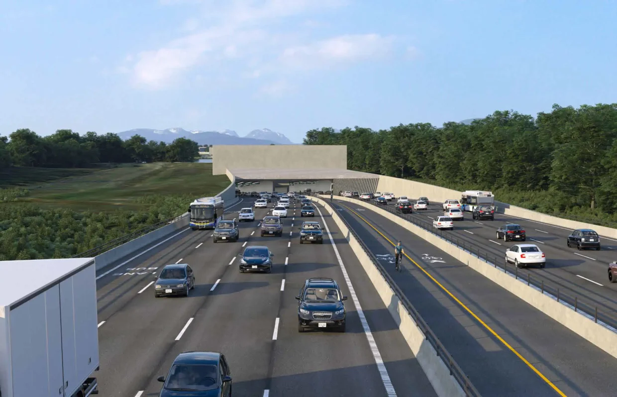
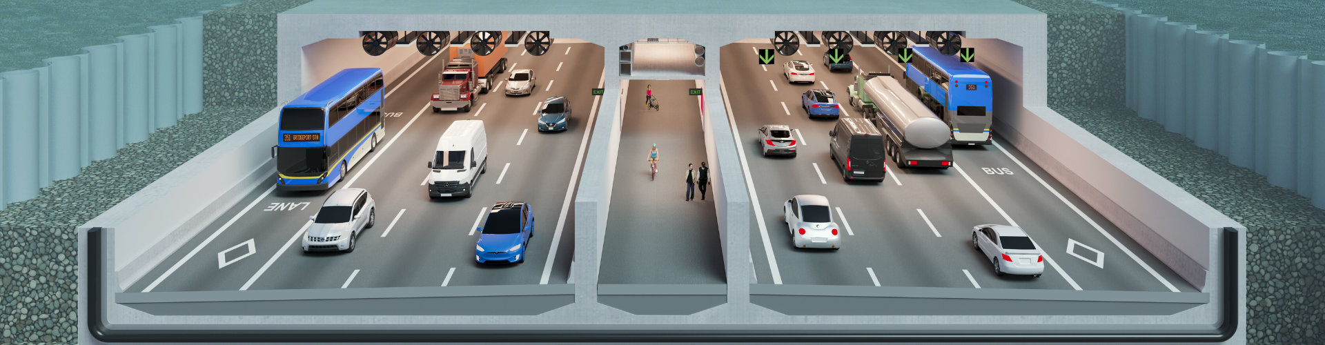
Narrow bridges provides strong symbolism of the cities narrow-mindedness. When bridges are too narrow, its difficult to have a proper express or rapid bus system. The reluctance to build parallel bus and HOV bridges helps to maintain the congestive planning approach that is vancouver and the Greater Region. 

Vancouver's refusal to build parallel bike bridges has meant that 2 lanes were removed from the Burrard Bridge, 1 lane from the Cambie Bridge and 2 lanes from the Granville Bridge. 

Keeping buildings symbolically short when compared to what scenic Sydney, Auckland, SF and Seattle allow, also helps to maintain Vancouver's reluctance to enter the big and tall urban scale. In fact, the scenic setting that Vancouver is in has been used as the main excuse to continually scale the city down. Yet, several scenic cities around the world are either able to have wider bridges, wider roads, longer trains or taller buildings. 

The world is mostly composed of non-white people. Canada has less than 1% of the world's population and stubborn Vancouver symbolically remains as a small provincial backwater on the Pacific Rim. 

https://centralparktower.com.au Unlike Perth, Vancouver forbids 50 story office towers and Brisbane, Sydney and Melbourne size residential towers. 

https://en.wikipedia.org/wiki/108_St_Georges_Terrace In fact, no office building in Vancouver has been permitted to have a 40th floor. However, since Burnaby and Surrey aren't under the restrictive controls of Vancouver, they will eventually allow office towers over 40 stories. 

Despite Australia having less people than Canada, Perth is allowed to have taller buildings, wider bridges and longer trains than Vancouver. Taller buildings, wider bridges and longer trains are even less likely in Halifax than whats in Brisbane or Queensland.

https://en.wikipedia.org/wiki/Q1_(building) To see buildings on a similar scale of what Brisbane allows, one has to get to Greater Toronto. Brisbane is allowed to have some buildings that would even be impressive in Melbourne and Sydney. 

While Montreal is allowed to have taller buildings than Vancouver, Montreal isn't allowed to have Sydney size towers. Especially not on the scale of what Melbourne and Toronto permit. 

Friday, January 30, 2026

Major upgrades for Queensborough Bridge in NW

 https://dailyhive.com/vancouver/queensborough-bridge-upgrades-new-westminster-richmond 

Another classic BC bottleneck-chokepoint. This bridge is so narrow, because there aren't any emergency lanes, let alone any bus & HOV lanes. The narrow and inadequate Queensborough+Bridge just wasn't designed for a properly growing seaport region. A twin or duplicate bridge should have been built immediately east of the first bridge, decades ago. A parallel 4 lane bridge would allow for 3 lanes on each bridge, plus a 4th lane for buses. However, that would go against the regional congestive planning agenda. 


https://jfdatalinks.blogspot.com/search?q=Queensborough+Bridge

Wednesday, January 7, 2026

Four Lane Pattullo Bridge Replacement Project

 https://www.youtube.com/watch?v=o-ING5Pfrdk 

The old bridge has 4 narrow lanes and no traffic divider. However, the new bridge won't have any bus or HOV lanes and no emergency lanes. 

Chokepoint-bottleneck planning remains firmly entrenched in backwards BC.

Wednesday, December 24, 2025

Partial opening of the Pattullo Bridge replacement

 https://www.youtube.com/watch?v=tDFkc9Oa-j0 

Unfortunatly, the old bridge is such bad shape that it can't be refurbished. Otherwise, each bridge could have provided 3 or 4 lanes each way. People will be in for a shock once the old bridge is dismantled. Then the new bridge will become just another classic 4 lane BC bottleneck-chokepoint. 

No bus lanes or HOV lanes and especially no wide emergency lanes. 


https://jfdatalinks.blogspot.com/search?q=Pattullo+Bridge

Wednesday, November 26, 2025

Pattullo to partially close for three nights as 4 lane replacement bridge opening draws near

 https://dailyhive.com/vancouver/pattullo-bridge-closures-replacement-opening 

No matter how much NW wants to be one of the smallest cities in backwards BC, it can't stop Surrey from eventually being the biggest city in what should be bustling BC. The SkyBridge was deliberately designed to not have any HOV or truck lanes. The narrow SkyBridge wasn't even designed to eventually become a bus and bike bridge. Just a train bridge without even any sidewalks. It really should have been given an award for one of the worlds best examples of inept urban infrastructure. 

It's like the SkyBridge (1990) was designed to be the first part of the new inadequate crossings between NW and Surry.

Indeed, just like its 1937 predecessor, the Pattullo_Bridge_replacement will open with only for lanes, but at least it will have 2 bike lanes and 2 sidewalks. The Pattullo_Bridge_replacement should have opened with 6 lanes and 2 wide shoulders or emergency lanes, but that would go against funneling everything into just 2 lanes each way. No emergency lanes or wide shoulders helps to reduce emergency vehicle inefficiency. No bus & HOV lanes helps to increase transportation congestion. Despite being a seaport region, there aren't any truck lanes. Perhaps the best feature of all is than the bridge wasn't designed to eventually have a lower deck for trains and trucks. 

Multibillion dollar bridges can be designed with future widening capabilities, or at least having a provision for a lower deck. Unfortunatly, it's very difficult for BC to design prober big city size transportation infrastructure. 

Saturday, November 22, 2025

Some Canada Mega-projects Under Construction

 https://www.youtube.com/watch?v=kwsOVZ-j7hg 

Oakridge_Park is on a much smaller scale than MetrotownBrentwood and Lougheed. It will especially be on a much smaller scale than Parramatta in NSW. 

Unfortunatly, the Oakridge-41st_Avenue_station was only designed to have 50m platforms, when it should have been at least 100m. Thus, the utter foolishness has meant that instead of allowing for a future level station clearance to accomodate 5 car trains, the Canada (embassament) Line was only designed to just have 2.5 car trains. While its extremely short stations might have been disguised as a cost saving measurer, there didn't seem to be any key people onboard to make sure that it could eventually become a proper big city train line. Its sad that a line which opened in 2009 is still only running 2 car trains. While the 2.5 car configuration is still a joke of a train, at least half of an extra coach-length is better than nothing. Plus, there should have been extra cars ordered by now so at least during the very busy times the trains could be operating at 1 minute headways. Unfortunatly, this goes against the Vancouver & BC congestion planning mentality.

Despite being built several years after the Sydney_Harbour_Bridge, the joke that is the Pattullo_Bridge was designed to only have 4 narrow lanes & only 1 sidewalk. Of course the replacement_bridge will only open with 2 lanes each way. It was as if someone really wanted to make sure that there won't be 2 bus lanes and no HOV lanes when the bridge opens. While the new bridge is designed to be expanded from a 4 lane joke to eventually having 6 lanes, it still won't be wide enough to accomodate 2 HOV lanes as well as 2 bus lanes. Of course the new bridge won't have any emergency lanes, just like the old bridge. However, it will have 2 bike lanes and 2 sidewalks. https://www.globalhighways.com/news/pattullo-bridge-completion-end-year Its only fitting that in backwards BC this new bridge wouldn't be designed to eventually have a lower deck to accomodate 2 bus lanes and 2 LRT tracks. 

If the planners were afraid to symbolically have a wide bridge between NW and Surrey, the old Pattullo_Bridge should have been designed to eventually have a lower deck for trams, trucks and busses. Even when the SkyBridge between NW and Surrey opened in 1990, it wasn't designed to have any bus lanes or emergency vehicle lanes and especially, no bike and footpaths. 

Is Vancouver the best city in North America? (2019) https://www.youtube.com/watch?v=P8dmVUrNt38

 One of the biggest mistakes in Vancouver & SW BC is to have short trains combined with mostly narrow bridges. Thus, the region doesn't get to have long, high capacity trains and there isn't a proper regional network of bus-bridges. The refusal to twin most of the bridges means that it's almost impossible to have a proper and efficient regional network of rapid-bus and HOV lanes.  

While Montreal built the REM to augment their long-train Metro system, Vancouver should have allowed for enough clearance to eventually have 500 foot long trains. 80m-50m Skytrain stations are going to become inadequate, when there should have been a 152.4m provision so that the trains could eventually become as long as the ones on the Montreal Metro. 

Is Regional Rail in the Future of British Columbia? https://www.youtube.com/watch?v=1PeIOVy6fFc

Wednesday, November 19, 2025

A Richmond encampment under the Oak Street bridge

 https://vancouver.citynews.ca/2025/11/19/growing-calls-to-clear-richmond-encampment 

Of course any neighborhood will be concerned when a bunch of people are living under a bridge and wandering around.

Living under a bridge is hardly affordable housing. There needs to be proper secure housing with plenty of security and staff to help people who are stuck living outside. 

That bridge is so narrow and inadequate. 

SW-Vancouver needs a proper transportation upgrade. Granville Street should be extended across the Fraser River on a parallel bridge to the Oak Street Bridge (OSB). Then, the 2 bridges could provide 4 general lanes each way. Plus, another 4-lane parallel bridge to accommodate 2 BRT lanes and 2 HOV lanes. 

Or, a totally built a new version of the Oak+St+Bridge that could provide 6 lanes northbound. Then, a Granville Street extension could provide 6 southbound lanes onto a new OSB. Four general lanes each way, plus a rapid bus lane each way & 1 HOV lane each way. 

For the most part, the Oak+Street-Granville+Street+Corridor has 12 lanes. A yellow paint strip designates 3 lanes each way. Instead, Oak could have 6 northbound lanes and Granville could have 6 southbound lanes. The 5th & 6th lanes could be for the Oak & Granville BRT lane & HOV lane on complete one way streets.

Unfortunately, the OSB remains as a 4 lane traffic bottleneck or chokepoint. 

The 2009 Canada (embarrassment) Line is still only using 2 car trains in 2025. A proper big city YVR-Canada Line should have been started with 5 car trains. Unfortunately, this joke of a train is only designed to ultimately run a 2.5 car train, someday. 

This stunted infrastructure approach is so absurd. Transportation planning in the most populated parts of BC is so inadequate, but its all part of backwards BC symbolism. The symbolism is all about showing a thwarted or watered down a city can be. Narrow bridges and short trains are some of the best ways to increase congestion and inefficiency in backwater BC.

Calgary ranked the top place for GTA families moving out of Ontario

 https://dailyhive.com/toronto/gta-families-move-to-calgary 

If you move from Toronto to Calgary, you will still be in a real city. However, Calgary has about a 3rd of the population. The GTA is so much more vast and dense than Calgary. The Calgary_Tower is only a 3rd of the height as the CN_Tower.

For those that move from Toronto, Montreal, Calgary or Edmonton to Vancouver, you will be shocked to see mostly 4 lane bottleneck-chokepoint bridges. The few 6 lane bridges in Greater Vancouver have no proper bus or HOV lanes, so its the epitome of congestion planning.

Wednesday, November 12, 2025

Bus, Bike and Footbridges

 https://www.tbtechno.com/en/portfolios/pergola-viaduct-of1-4b-bus-hov-lanes/ 

https://stvinc.com/project/verrazzano-narrows-bridge-bushov-lane-implementation-design/ 

https://seattletransitblog.com/2025/01/29/wsdot-hov-overview/ 

https://bikeportland.org/2017/05/11/is-it-time-for-more-bus-only-lanes-in-portland-228020

https://vancouver.ca/streets-transportation/bus-network-improvements.aspx


https://ipvdelft.com/bicycle-bridges/

https://www.arch2o.com/10-amazing-bridges-passageways-bikes/

https://hansonthebike.com/2017/07/11/dutch-bike-bridges/ 

https://mtc.ca.gov/operations/regional-trails-parks/san-francisco-bay-trail/explore-trail/bridges-bay-trail 

https://mtc.ca.gov/operations/programs-projects/bridges/san-francisco-oakland-bay-bridge/bay-bridge-east-span-path

https://www.curbed.com/2021/04/brooklyn-bridge-bike-lane-narrow.html 

https://www.timeout.com/newyork/news/the-brooklyn-bridge-is-finally-getting-a-bike-lane-before-the-end-of-the-year-040921

https://www.vancouverisawesome.com/tri-city-news-archive/news/new-bridge-bike-path-needs-better-access-hub-3014166


https://www.asiarealestatesummit.com/pedestrian-bridges-and-infrastructures-that-connect-public-spaces-and-other-stories/ 

https://www.benesch.com/project/43rd-street-pedestrian-bridge/

https://surfarchitecture.com/a-new-suspended-pedestrian-bridge-over-the-water-in-toronto

https://www.guinnessworldrecords.com/world-records/581364-longest-enclosed-pedestrian-bridge 

https://www.mediaoffice.ae/en/news/2025/september/14-09/rta-builds-six-new-pedestrian-and-cyclist-bridges-across-major-dubai-roads

https://www.conteches.com/bridges-structures/truss-and-girders/continental-pedestrian-bridge/

Thursday, November 6, 2025

Expect noise, vibration during upcoming Massey Tunnel replacement

 https://www.delta-optimist.com/local-news/expect-noise-vibration-during-upcoming-massey-tunnel-replacement-11436394 This B$ should have been done a few decades ago.

A 10 lane bridge with 2 bus lanes, 2 HOV lanes & 2 wide shoulder-emergency lanes, plus at least 3 general lanes each way, could have been a nice wide crossing. Some 12 lanes, including the 2 emergency lanes. Plus, a provision for at least 2 LRT tracks. 

Instead, it's a 3 lane each way tunnel with the 4th being a bus lane. No HOV lanes and no emergency lanes & especially, no train tube section. 

So, just like the YVR-Canada (embarrassment) Line, this new 8 lane tunnel will eventually require some major upgrades. 

Eventually, a YVR-Canada Line bridge or tunnel will have to be built so that someday, trains can go between the airport and the ferry terminal. Such a train crossing should be parallel to the new highway tunnel. A new train tunnel or bridge should have at least 3 tracks, 2 rapid bus lanes and 2 bike lanes and sidewalks. Then the bus lanes in the highway tunnel could become HOV lanes. 


https://jfdatalinks.blogspot.com/search?q=Massey+Tunnel+replacement 

https://jfdatalinks.blogspot.com/search?q=Richmond+and+Delta

Sunday, October 26, 2025

All cables and final steel girders now installed for new Pattullo Bridge

 https://dailyhive.com/vancouver/pattullo-bridge-construction-milestone-cables-deck Unlike the old, inadequate bridge, which only has 4 narrow lanes and just 1 sidewalk, this will have 2 sidewalks and 2 bike lanes. Unfortunatly, there won't be any bus or HOV lanes. Thus, all the traffic will be funneled into just 2 lanes each way. Of course there won't be any emergency lanes or breakdown lanes, so this is another quintessential BC bottleneck by design. At least a provision for a lower deck would have provided some hope. While this bridge can eventually be widened to 6 lanes, there seems to be no serious consideration for there to be bus and HOV lanes. So it will end up like the overloaded 6 lane Iron Bridge.

https://en.wikipedia.org/wiki/SkyBridge_(TransLink) No bike lanes and sidewalks and it wasn't built wide enough to eventually accomodate 3-4 tracks and 2 bus lanes. There is just something about backwards BC that makes it so obtuse and inept. 

https://upload.wikimedia.org/wikipedia/commons/thumb/1/1d/SkyBridge_from_SkyTrain_%285770458210%29.jpg/500px-SkyBridge_from_SkyTrain_%285770458210%29.jpg At the very least, this bridge should have had 3 tracks and 2 bus lanes, a bike lane and a sidewalk on a lower deck. There is only a middle service track and apparently, no provision for a bike lane and a sidewalk.

https://en.wikipedia.org/wiki/New_Westminster_Bridge Still, only a single track bridge for freight and passenger trains. 

https://upload.wikimedia.org/wikipedia/commons/thumb/1/1f/New_Westminster_Swing_Bridge.jpg/960px-New_Westminster_Swing_Bridge.jpg This old single track bridge should have been double tracked on a lower deck and have at least 4 lanes on an upper deck. Then when the first 4 lane Pattullo Bridge opened, it might not have been quite as overloaded in its later decades. 

In order for this joke of a river railway crossing to be properly upgraded and efficient is for there to be at least a new double track bridge.  

NW should have really had something like its own version of the Steel_Bridge in Portland. 

https://upload.wikimedia.org/wikipedia/commons/thumb/5/51/Amtrak_talgo_train_crossing_steel_bridge.jpg/960px-Amtrak_talgo_train_crossing_steel_bridge.jpg Fortunatly, Portland didn't have a provincial backwater mentality like NW. Thus, they could build a lot more bridges. 
https://upload.wikimedia.org/wikipedia/commons/thumb/8/80/SteelBridgePano1.jpg/960px-SteelBridgePano1.jpg MAX light rail on the upper deck and Amtrack and freight trains on the lower deck. Fortunately, Oregon is far enough away from ever catching the BC Mind Virus. 
https://upload.wikimedia.org/wikipedia/commons/thumb/e/e3/Aerial_view_of_Willamette_River_crossings_in_Portland%2C_February_2018.JPG So many nice bridges in Portland. 
 
There is such a the lack of bridges between NW and Surrey.
https://upload.wikimedia.org/wikipedia/commons/thumb/0/0a/New_Westminster_Aerial_view_2015.jpg/960px-New_Westminster_Aerial_view_2015.jpg For most of the history of NW, Surrey was just some farmland south of the river with not much going on, but its many times larger than little NW. 

There just didn't seem to be that much a big city vision for little provincial backwater NW. Back in the day, NW could have acquired what would become the Tri-Cities and perhaps, even Surrey. There just wasn't any desire to have a big river city in BC on the scale of Portland,_Oregon. So while NW is stuck as a tiny city, Surrey is on its way to becoming the biggest city in BC.

Unfortunately, the Iron Bridge and Granville Bridge were never designed to have a lower deck for trains and buses either. That's just how it is in backwards BC.