https://en.wikipedia.org/wiki/Stadium_Place
https://urbanash.com/blog/stadium-place-seattle-pioneer-square/
https://seattle.curbed.com/2018/3/20/17144018/embassy-suites-hotel-centurylink-field
Any port city & metropolitan region with several narrow bridges must be proactive. Thus, there should have been a plan to build a series of bus & truck bridges.
Unless there is a proper amount of transportation infrastructure funding, it's all a joke. Such is the nature of backwater BC.
https://www.reddit.com/r/vancouver/comments/a1x7rp/ever_wondered_what_rapid_transit_in_vancouver
Fortunately, the backward Vancouver mentality never made it to Melbourne, HK, SF, NO, Philadelphia, Boston & Toronto.

https://dailyhive.com/vancouver/surrey-city-centre-future-skyline-downtown
Having been forced to live in Cloverdale as a teenager, I would never want to live in Surrey again. However, whenever Surrey can become the biggest city in BC, then Langley & Delta will all become part of a nice urban area of well over a million people south of the Fraser River.
However, without the necessary urban infrastructure, it will just become another half-assed BC endeavor.
Even if most of the farmland can remain protected, huge farm conglomerates could eventually buy up all of the smaller farms from families that could use the extra cash. Then the farm & food conglomerates can have more leverage to do what they want with the land. Thus, the ALR should have had a provision to help keep the farms as a family business.
Urban densification can easily evolve around the farmland. The Metropolitan Vancouver Region is surrounded by mountains, forests, farmland & water. But that didn't stop Montreal & Seattle from becoming proper big urban areas.
Excrete financial resources so that there isn't enough money for longer trains and bus bridges.
https://googlemapsmania.blogspot.com/2018/08/the-streetcars-of-san-francisco.html
Streetcars and trams were gotten rid of in Vancouver & Victoria by the mid 1950s. Vancouver will likely be one of the last major cities to bring them back. It's such a backwards mentality to totally block out a key mode of transit.
Its cool how the CTrain runs down the middle of Memorial-Drive. Just like the C_Line and_Interstate_105 in LA go well together. Unfortunatly, backwards Vancouver isn't allowed to function like a proper big city like SF, Melbourne and Toronto...
https://upload.wikimedia.org/wikipedia/commons/c/c9/Inbound_N_Judah_train_boarding_at_48th_Avenue%2C_September_2019.JPG Almost like a tram-train in Melbourn, but it's in SF.
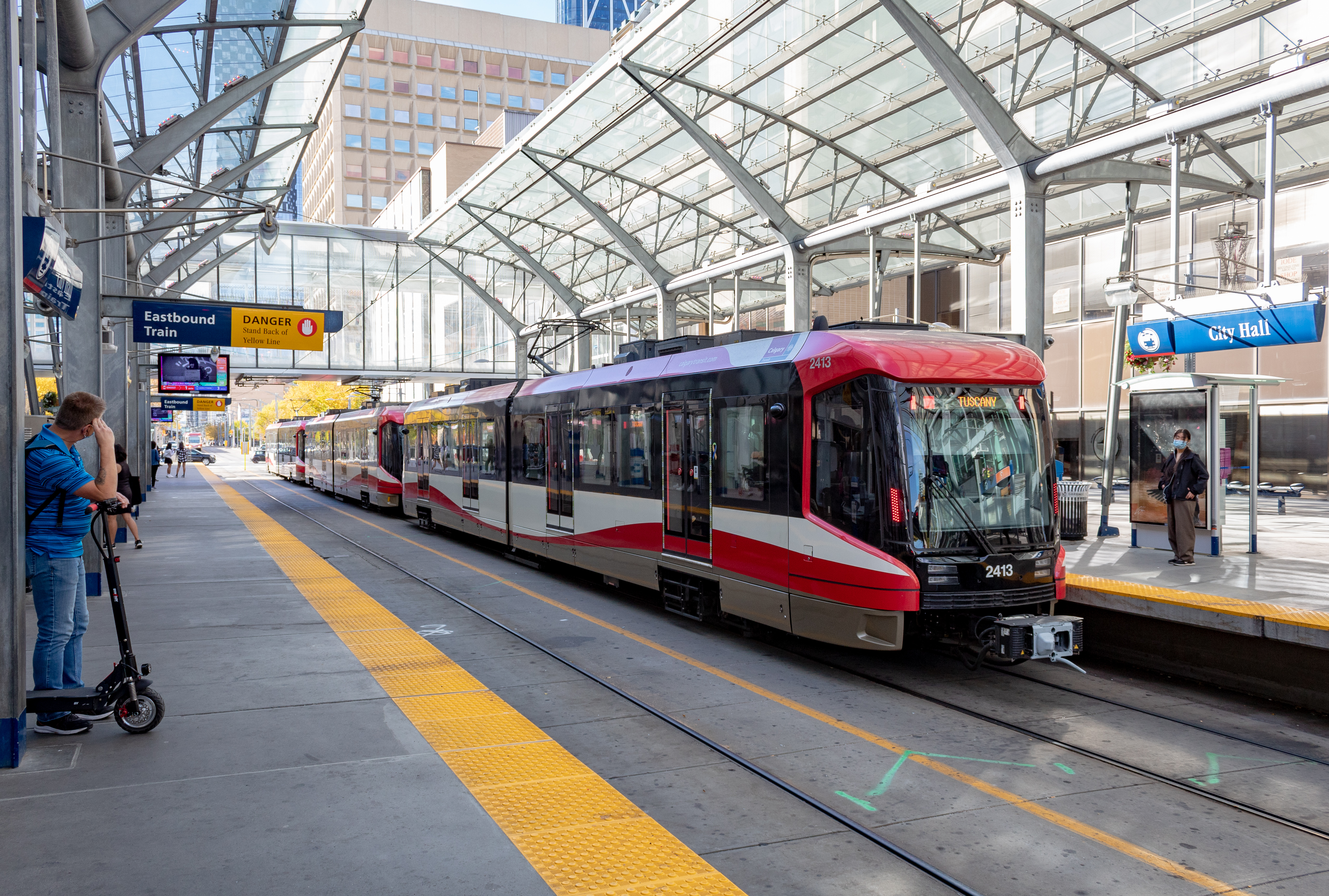
https://upload.wikimedia.org/wikipedia/commons/c/c9/S200_CTrain_leaving_City_Hall_Station.jpg
https://en.wikipedia.org/wiki/CTrain Calgary
https://en.wikipedia.org/wiki/C_Line_(Los_Angeles_Metro)
https://en.wikipedia.org/wiki/A_Line_(Los_Angeles_Metro)
https://en.wikipedia.org/wiki/E_Line_(Los_Angeles_Metro)
https://en.wikipedia.org/wiki/K_Line_(Los_Angeles_Metro)
https://en.wikipedia.org/wiki/G:link GC
https://en.wikipedia.org/wiki/Inner_West_Light_Rail Sydney
https://en.wikipedia.org/wiki/Premetro_(Buenos_Aires)
https://en.wikipedia.org/wiki/Streetcars_in_New_Orleans
Its always amazing to see what other cities are allowed to do, simply because they aren't in BC.
https://kumtuks.ca/streetcars-and-metro-vancouver/
https://evelazarus.com/bring-back-the-streetcar/
https://scoutmagazine.ca/how-to-find-the-old-streetcar-scars-of-east-van/
https://www.facebook.com/VancouverCivicRailway/photos
https://www.vancouverisawesome.com/history/last-ride-oak-streetcar-vancouver-1937040
https://stephenrees.blog/2012/04/11/is-it-time-to-bring-back-the-streetcar-to-vancouver/
https://thetyee.ca/News/2010/10/01/Streetcars/
https://council.vancouver.ca/990323/tt1.htm
https://evelazarus.com/the-train-that-ran-down-hastings-street/
https://dailyhive.com/vancouver/bute-robson-plaza-historic-streetcar-tracks-construction
https://searcharchives.vancouver.ca/robson-line-streetcar-at-english-bay
https://en.wikipedia.org/wiki/Robson_Street#History
https://westendvancouver.wordpress.com/historical-background/streetcars/
https://montecristomagazine.com/community/vancouvers-forgotten-streetcars
https://scoutmagazine.ca/how-to-find-the-old-streetcar-scars-of-east-van/
https://kumtuks.ca/streetcars-and-metro-vancouver/
https://www.cbc.ca/news/canada/british-columbia/kelowna-bennett-bridge-closure-1.7442622
This is why it's a good idea to have another bridge in the region.
https://globalnews.ca/news/10979322/william-bennett-bridge-closed-police-incident/
The 1930s Pattullo-Bridge just wasn't designed for what should be a major Pacific seaport region.
Unlike Sydney, Australia & SF, California in the 1930s, NW always had a provincial backwater mentality. NW should have acquired the Coquitlams in order to attempt to be a big city, but that would go against its BC backwater agenda. Surrey in the 1930s was never envisioned to be that much of anything. No one ever thought that almost a century ago, that Surrey could eventually become the most populated city in backward BC.
https://www.cbc.ca/news/canada/british-columbia/pattullo-bridge-closure-1.7442030
Unfortunatly, with so much of the infrastructure in BC, it wasn't designed for future expansion or capacity upgrades.
https://vancouversun.com/news/fatal-five-vehicle-crash-pattullo-bridge
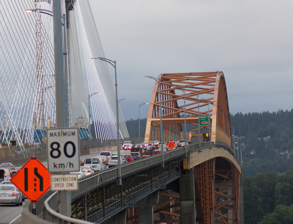
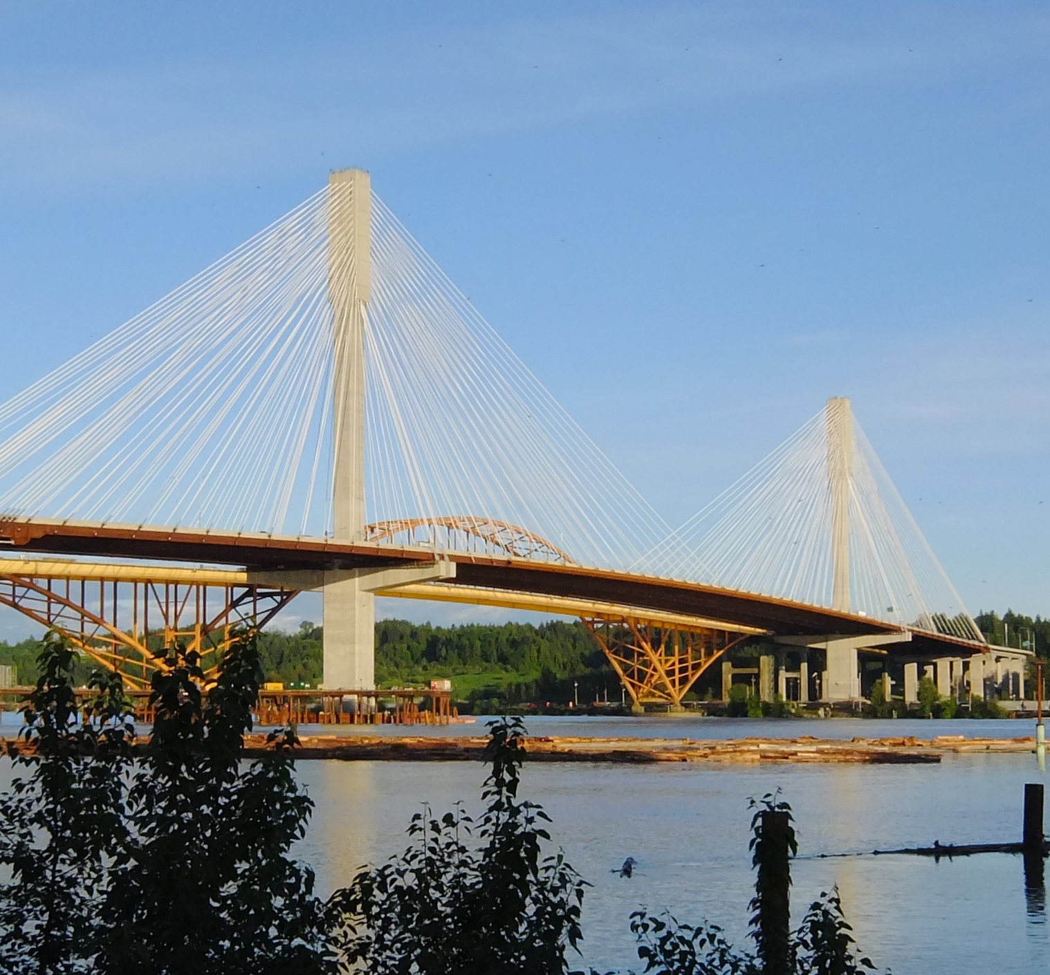
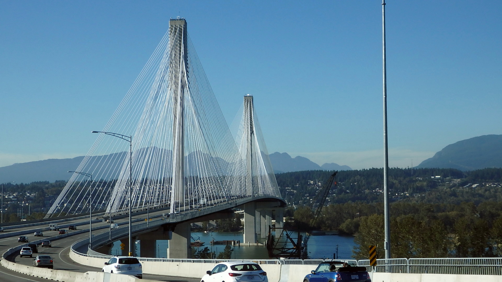
https://www.pattullobridgereplacement.ca The new bridge only has a few basic improvements, but still will initially only provide 2 lanes each way. It should have opened with 3 lanes each way & with a provision for an equally wide lower deck. Such a lower deck could have allowed for a bus & HOV lane each way, plus a truck lane each way. Also, enough clearance for 2 LRT tracks.
https://www.pattullobridgereplacement.ca/about/projectoverview When the old bridge opened, it only had 1 narrow sidewalk & only enough space for 2 narrow lanes each way. There was no concept to have a couple of bus & a couple of truck lanes. There was a lost opportunity to have a lower deck for 2 streetcar tracks & 2 interurban or tram-train tracks. BC just doesn't have that much of a visionary perspective of things.
https://jfdatalinks.blogspot.com/search?q=Pattullo+Bridge
https://jfdatalinks.blogspot.com/search?q=Pattullo+Bridge+replacement
https://www.reddit.com/r/VictoriaBC/comments/ad2dl9/victoria_was_the_third_city_in_canada_with/
Unfortunatly, like backwards Vancouver, they also got rid of their streetcars.
https://en.wikipedia.org/wiki/List_of_street_railways_in_Canada
https://evelazarus.com/the-train-that-ran-down-hastings-street/
The Mission_Bridge should have been twinned by now. However, some people freak out with the concept of two 4 lane parallel bridges in BC. That would allow for 3 general lanes each way, plus a bus - HOV lane each way. There should also be an LRT line between Abbotsford+and+Mission on its own mostly grade separated right of way.
https://en.wikipedia.org/wiki/Mission_Bridge#Highway_bridge_construction_and_opening
A bus & HOV lane each way, plus a truck lane each way, as well as 2 general lanes each would improve on shipping & commuting needs. A new parallel bridge could also accommodate ample bike & footpaths.
https://vancouver.citynews.ca/2025/01/24/mission-crash-closes-bridge-abbotsford/
This segment is already wide enough to accomodate 8 lanes. However, this highway connector has yet to be completed, let alone a new bridge.
https://www.rome2rio.com/s/Mission-BC-Canada/Abbotsford
https://www.bctransit.com/hope/schedules-and-maps/route-overview/?route=31
https://www.abbotsford.ca/city-services/transportation-roads/trucks-and-commercial-goods
https://dailyhive.com/vancouver/translink-stanley-park-drive-bus-route-proposal
There should also be a downtown bus loop.
https://dailyhive.com/vancouver/vancouver-floating-hotel-sunborn-concept
There will be some people that will try to ban this, because they always want Vancouver to be a watered-down, boring backwater of a city.
https://en.wikipedia.org/wiki/Knight_Street
https://council.vancouver.ca/20050329/tt5App1.pdf
The Knight+Street+Corridor mostly has the potential to provide 3 lanes each way. However, the middle of the Knight_Street_Bridge and the Clark Drive diversion only has 2 lanes each way. However, by 12th Avenue, Clark Drive would be 6_lanes_wide up to Hastings Street.
https://en.wikipedia.org/wiki/Angus_L._Macdonald_Bridge , https://www.google.com/maps/place/Angus+L.+Macdonald+Bridge/@44.6643611,-63.5847599,265m/data=!3m1!1e3!4m15!1m8!3m7!1s0x4b4513bbd026ebc5:0xcd90670d5a4a675b!2sHalifax+Regional+Municipality,+NS!3b1!8m2!3d44.8857087!4d-63.1005273!16zL20vMDM2azBz!3m5!1s0x4b5a2160af03fd89:0x8025000ffacdc8de!8m2!3d44.6645517!4d-63.5839728!16s%2Fg%2F11ck63t_40?entry=ttu&g_ep=EgoyMDI1MDEyMS4wIKXMDSoASAFQAw%3D%3D
https://en.wikipedia.org/wiki/Lions_Gate_Bridge , https://www.google.com/maps/place/Lions+Gate+Bridge/@49.315061,-123.1446245,1133m/data=!3m1!1e3!4m15!1m8!3m7!1s0x548673f143a94fb3:0xbb9196ea9b81f38b!2sVancouver,+BC!3b1!8m2!3d49.2827291!4d-123.1207375!16zL20vMDgwaDI!3m5!1s0x548671e4314afbf5:0x3e51e1a4f59d56fa!8m2!3d49.315048!4d-123.1390072!16zL20vMDJkZ25i?entry=ttu&g_ep=EgoyMDI1MDEyMS4wIKXMDSoASAFQAw%3D%3D
https://en.wikipedia.org/wiki/Johnson_Street_Bridge , https://www.google.com/maps/place/Johnson+Street+Bridge/@48.4281926,-123.373651,380m/data=!3m1!1e3!4m15!1m8!3m7!1s0x548f738bddb06171:0x38e8f3741ebb48ed!2sVictoria,+BC!3b1!8m2!3d48.4284207!4d-123.3656444!16zL20vMDd5cHQ!3m5!1s0x548f749c9ec2d143:0x5a83be27f477e403!8m2!3d48.4282598!4d-123.3721465!16zL20vMDQzMThs!5m1!1e2?entry=ttu&g_ep=EgoyMDI1MDEyMS4wIKXMDSoASAFQAw%3D%3D
The Lion+Bridge should be renamed the Onion Bridge, because it causes so many people to cry in frustration. Why not at least have a bus, HOV & train tunnel there? Unfortunately, that would go against the congestive planning mentality that is Vancouver & backwards BC.
https://dailyhive.com/vancouver/1111-broughton-street-vancouver-social-housing-tower
There has been a muntigerational fear and cultivation to use the local mountains_of_British_Columbia as an excuse to keep Vancouver thwarted & backwards. Yet, most of BC is a mountainous wilderness. Indeed, there are only a handful of cities or urban areas in BC to flourish and thrive. Greater Vancouver & Greater Victoria-Prince+George-Kamloops and Prince Rupert.
Kelowna, Vernon & Penticton are set to be the largest urban region between Vancouver & Calgary.
https://www.hellobc.com/travel-ideas/mountains , https://peakvisor.com/adm/british-columbia.html
Montreal & Toronto are specks when compared to the wilderness ladndmasses of Quebec & Ontario. NYC & Chicago have hardy overtaken NY State & Illinois. Greater Seattle takes up a small part of Washington State. Calgary & Edmonton are small areas within the Albertan landmass.
Yet somehow, if Greater Vancouver was allowed to become a proper metropolis, it would overwhelm BC. An area where Switzerland can fit into 23 times. Yet, BC has yet to reach the population of 1 Ch. Canada is nowhere close to containing 1% of the worlds population.
https://en.wikipedia.org/wiki/Geography_of_British_Columbia
https://en.wikipedia.org/wiki/Provinces_and_territories_of_Canada
https://jfdatalinks.blogspot.com/search?q=Kelowna-Victoria-Prince+George-Kamloops
or
https://jfdatalinks.blogspot.com/search?q=Victoria-Kelowna-Kamloops-Prince+George
A lot of the secondary cities in each state could become big in their own right.
Texas has a lot more people than Australia, yet it's a much smaller area & still has plenty of room.
https://www.sciencedirect.com/science/article/pii/S1353829222001605
https://www.infrastructureaustralia.gov.au/sites/default/files/2019-06/future-cities-paper-web.pdf
https://scenariojournal.com/article/made-in-australia
Of course one expects Melbourne and Sydney to have all the big stuff. However, from a Canadian perspective, it's amazing to see that Australia has a 12 lane crossing in Brisbane & a 10 lane crossing in Perth. Such wide bridges just don't exist in Halifax, NS & Victoria, BC.
https://en.wikipedia.org/wiki/Sir_Leo_Hielscher_Bridges 12 lanes.

https://en.wikipedia.org/wiki/Narrows_Bridge_(Perth) 10 lanes.
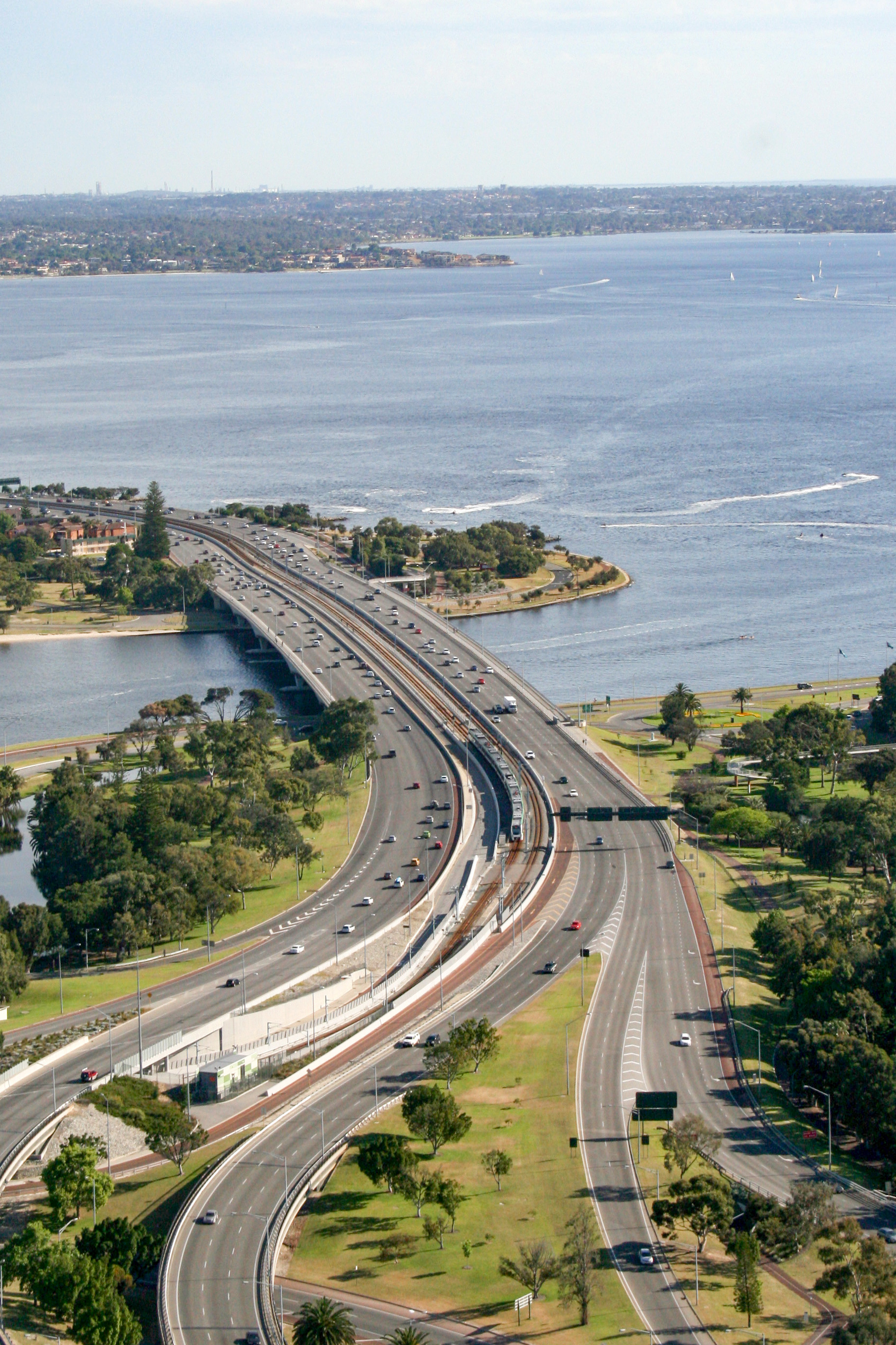
https://en.wikipedia.org/wiki/Narrows_Bridge_(Perth)#Railway_bridge:_2005 Seattle & Montreal would end up having their own version of a wide bridge with a train component as well. Of course, stubborn & backwards Greater Vancouver would be one of the last urban areas to ever allow such similar bridges.
It doesn't look like anyone from Canada was ever able to convince Australians to give up on bridge duplication & opt to just cram everything into 4 lanes or an inept 3+lane+bridge for two-way traffic.
Fortunately, Queensland, the other Sunshine+State doesn't seem to have this occasional problem.
Several people temporarily leaving cold Canada to live in cold Florida for the winter, WTH?
https://www.mtfxgroup.com/post/a-canadian-snowbird-s-guide-to-florida/
https://www.zoocasa.com/blog/moving-canada-florida/
https://www.snowbirdadvisor.ca/guide-floridas-east-coast-canadian-snowbirds
https://www.fox13news.com/weather/florida-eh-why-snowbirds-in-canada-love-heading-south
Many people might have been better-off visiting Queensland, the other Sunshine+State.
https://dailyhive.com/vancouver/waterfront-road-emergency-closure-vancouver
https://dailyhive.com/vancouver/waterfront-road-vancouver-public-access-closure
Being a port city & region, there should have been a port road along the south side of the inlet, several decades ago.
https://www.blogto.com/city/2025/01/ttc-outage-emergency-rail-repair/
If every major subway & metro train line had 4 tracks, it would be so much easier to do maintenance & repairs. Even a triple track line would allow more flexibility.
Fortunately, no one from backwards Vancouver or backwater BC was ever able to thwart or stunt the progress of Montreal & especially Toronto from becoming real mighty cities. Calgary & Edmonton have also benefited by not being under anything like the backwater BC mentality.
Unfortunatly, most of Canada gets crappy cold winter weather & before things got ridiculously expensive in BC, people would increasingly move to Victoria & Vancouver to escape the harsh winters.
Greater Victoria hasn't been allowed to become a mighty city like Sydney, Australia or Montreal. Thus, it remains as a quintessential provincial backwater. Watered-down Vancouver hasn't been allowed to become a major city like Seattle. Indeed, Greater Vancouver's urban planning agenda has done almost everything possible to make sure that nothing on the scale of the GTA, the SF Bay Area or Melbourne, Australia exists in backwater BC. All one has to do is look at how small & inept most of the infrastructure is.
https://dailyhive.com/vancouver/red-square-metro-vancouver-building-burnaby
https://www.skyscrapercenter.com/complex/1224
https://skyscraperpage.com/forum/showthread.php?p=9743001
https://www.biv.com/news/real-estate/burnabys-kingsway-corridor-grows-up-8234808
Despite being smaller in population & area, Burnaby is starting to think on a grander scale than Vancouver, in some ways. Unlike Vancouver, Burnaby never went to the absurd extent of creating so much red tape & B$. Indeed, Vancouver has imposed several restrictions throughout the decades, that it has become trapped within its own Gordian_Knot, where as Burnaby is able to cut right through it.
https://www.urbanyvr.com/bosa-brentwood-west/
https://www.urbanyvr.com/amazing-brentwood-and-lougheed-update/
https://versus.com/en/chicago-vs-toronto
https://www.reddit.com/r/chicago/comments/ry7m6r/im_always_bewildered_by_the_similarity_between/
http://www.chicagosistercities.com/sister-cities/toronto-canada/
https://www.reddit.com/r/skyscrapers/comments/1f2jxtz/what_great_lake_cluster_is_more_dense_toronto_or Unlike Asia, the USA & Australia, Canada has no building with at least 100 floors, so far.
https://www.reddit.com/r/skyscrapers/comments/1bqx5iw/future_toronto_vs_current_chicago/#lightbox
https://dilemma-x.net/2013/03/07/torontos-population-overtakes-chicago
https://vancouver.citynews.ca/2025/01/18/vancouver-city-council-cambie-street-bridge-funding/
The Cambie-Street-Bridge should have been designed with very wide sidewalks so that a bike path & a walkway were on each side. Then, no lanes would have been removed, as was the case with the Burrard Street Bridge. Unfortunatly, there wasn't any concept to have wide sidewalks on the 1950s Granville Street Bridge, so now 2 lanes are removed, just like on the Burrard Bridge.
https://jfdatalinks.blogspot.com/search?q=Cambie+Street+Bridge
The movie Skyscraper was filmed in backwater BC, where as of 2025, no office building has a 40th floor, let alone 50 or 60 stories.
https://florida-first.com/why-florida-is-and-isnt-the-sunshine-state/
Florida and Queensland both consider themselves as being a Sunshine+State.
https://fortlauderdalemagazine.com/australias-sunshine-state/
https://en.wikipedia.org/wiki/List_of_metropolitan_areas_of_Florida
https://en.wikipedia.org/wiki/Florida#Transportation
https://en.wikipedia.org/wiki/Florida#Cities_and_towns
https://en.wikipedia.org/wiki/Florida#Intercity_rail
https://en.wikipedia.org/wiki/Queensland#Cities
https://en.wikipedia.org/wiki/Queensland#Infrastructure
https://www.urbanyvr.com/south-granville-subway-station/
https://thestoriessouthgranville.com/
https://dailyhive.com/vancouver/1477-west-broadway-skytrain-south-granville-station-tower-approved
https://storeys.com/gracorp-broadway-south-granville-tower/
https://dailyhive.com/vancouver/broadway-plan-vancouver-taller-towers
https://dailyhive.com/vancouver/vancouver-building-urban-growth-organic-broadway-plan
https://dailyhive.com/vancouver/broadway-plan-redevelopment-tenant-evictions-impact
https://dailyhive.com/vancouver/ottawa-airport-yow-line-4-airport-link-train-downtown
Even before Montreal.
https://en.wikipedia.org/wiki/Airport_station_(Ottawa)
https://www.octranspo.com/en/our-services/stations-2/airport-01
https://www.yow.ca/about-yow/media-room/news/city-of-ottawa-o-train-starts-at-yow
https://www.cbc.ca/player/play/video/9.6615560
https://ottawacitizen.com/opinion/dudas-rail-link-ottawa-airport
https://www.cbc.ca/news/canada/ottawa/climb-aboard-ottawa-s-new-and-improved-trillium-line-1.3587749
An airport+line usually indicates that a railway terminal is there. However, in several cases, there just might be 1 or 2 airport stations on a general line.
https://en.wikipedia.org/wiki/Noyo_River_Bridge
https://www.sfgate.com/northcoast/article/fort-bragg-push-suicide-barriers-noyo-bridge-20036591.php
Bridges should have higher railings so that it's much more difficult to jump off.
https://mendovoice.com/2025/01/dental-records-positively-i-d-missing-teen-found-dead-under-bridge/
Hopefully, the backward Vancouver city planners won't try to influence any lane removals on the 6 lane Golden_Ears_Bridge. As long as the GE Bridge is allowed to retain its 6 lanes, it can have 2 effective BRT lanes, along with 4 general lanes.
https://en.wikipedia.org/wiki/Golden_Ears_Bridge , https://images.drivebc.ca/bchighwaycam/pub/html/www/827.html
The Metro_Vancouver_Regional_District should have pushed for express bus lanes & the eventual BRT decades ago. However, there is such a fear of adding more lanes, even in the form of BRT & HOV lanes. Ideally, it's also good to have truck lanes since Greater Vancouver is a seaport.
https://www.infrastructurebc.com/projects/operational-complete/golden-ears-bridge/
https://www.heidelbergmaterials.com/en/reference-projects/golden-ears-bridge
https://en.wikipedia.org/wiki/Golden_Ears_Way
https://macleans.ca/economy/why-canadas-housing-crisis-is-not-just-a-supply-and-demand-problem/
The Tehachapi Loop, one of California's railroad wonders https://www.sfgate.com/travel/article/california-train-loop-wonders-railroad-world-20033899.php
Whether it's in the 2030s or in the 2040s, Surrey will become the largest city in BC. Therefore, it should eventually have at least one one of the tallest office towers in BC & one of the tallest residential towers in BC as well. Surrey went from having one of the most narrow bridges in BC to having the widest bridge in BC.
Unfortunatly, the Expo_Line_(SkyTrain) in_Surrey_and_Langley won't have the longest train stations, because the first 2 lines can only handle 5 car trains at the stations. However, with selective_door_operation, there could eventually be 7 car trains. https://en.wikipedia.org/wiki/Expo_Line_(SkyTrain)#Capacity_upgrades Getting stations to go from handling 5 car trains to 7 car trains, would be a great achievement. Ultimately, there should eventually be 9 car trains, just like on the Montreal_Metro.
https://en.wikipedia.org/wiki/Surrey,_British_Columbia#Geography
https://en.wikipedia.org/wiki/Langley_Memorial_Hospital
BC has taken a multigenerational slow growth perspective. The down side of this approach is not keeping up with various kinds of infrastructure. Having enough medical staff & facilities is essential for a growing BC.
https://en.wikipedia.org/wiki/Fraser_Health#Regional_hospitals
https://news.gov.bc.ca/releases/2021HLTH0070-000681
As of 2025, Langley has a population of around 150K & the City of Langley has around 33K. Thus, its an area with 183K & growing.
https://dailyhive.com/vancouver/19677-19653-19665-willowbrook-drive-langley-township-skytrain-towers
https://vancouverstreetstories.com/histor-of-south-vancouver
https://hscr.com/south-vancouver-neighbourhood-guide
https://sunsetonfraser.com/brief-history-of-fraser-street
https://www.vancouverheritagefoundation.org/discover-heritage/heritage-in-schools/#event-14464
https://en.wikipedia.org/wiki/Vancouver_South_(federal_electoral_district)
https://en.wikipedia.org/wiki/History_of_Vancouver
https://www.flickr.com/photos/vancouver-archives/5613988306/in/photostream 1946
https://www.flickr.com/photos/vancouver-archives/5613988284/in/photostream 1946
https://jolegacy.ca/fraser-street-1912
Of course the streetcar line on Fraser+Street was removed. It could have provided a vital transportation link between Vancouver and Richmond. https://vancouverstreetstories.com/fraser-street-streetcars
https://open.library.ubc.ca/viewer/bcbooks/1.0376523#p3z-5r0F:
https://jfdatalinks.blogspot.com/search?q=Knight+Street+Bridge
https://www.getaway.co.za/destinations/world/is-rio-de-janeiro-more-beautiful-than-cape-town
https://en.wikipedia.org/wiki/Rio_de_Janeiro
https://www.reddit.com/r/OldPhotosInRealLife/comments/11we8ql/rio_de_janeiro_brazil_1930_and_now
https://www.mywanderlust.pl/not-so-great-rio
https://www.rome2rio.com/s/Cape-Town/Rio-de-Janeiro
https://www.clipperroundtheworld.com/partnerships/insight/4-similarities-between-rio-and-cape-town
https://www.timeout.com/news/its-official-time-out-has-crowned-the-worlds-best-city-in-2025-011525
https://en.wikipedia.org/wiki/Cape_Town
"Portside is a 139-metre-tall (456 ft) building in Cape Town, South Africa. Completed in 2014, it is the city's tallest building[3] and, at the time of completion, was Cape Town's first significant skyscraper developed in the central business district (CBD) in 15 years." https://en.wikipedia.org/wiki/Portside_Tower 32 floors.
https://www.timeout.com/cape-town
https://versus.com/en/cape-town-vs-rio-de-janeiro
https://www.rome2rio.com/s/Cape-Town/Rio-de-Janeiro
Rio+de+Janeiro is a much larger city than CT and just as scenic.
https://www.clipperroundtheworld.com/partnerships/insight/4-similarities-between-rio-and-cape-town
https://dailyhive.com/vancouver/cambie-street-bridge-vancouver-seismic-upgrade-plan
https://www.flickr.com/photos/vancouver-archives/5613443337/in/photostream There could have been 5 bridges crossing F Creek, but the backwater BC mentality kicked in.
https://www.flickr.com/photos/vancouver-archives/5613432237/in/photostream/
So while Vancouver gave up on building that many bridges, Portland really built a fine series of bridges.
https://jfdatalinks.blogspot.com/search?q=Cambie+Street+Bridge
Officially, there isn't suppose to be a backwards BC agenda. However, the Skybridge between NW & Surrey and the North_Arm_Bridge between Vancouver & Richmond, were designed too narrow. Unfortunately, both of these SkyTrain+bridges weren't designed to have 2 bus lanes, or even HOV lanes. Key people knew that the SkyTrain wasn't going to be running 24hrs a day. Thus, there would have to be late-night busses when the trains shut down for the night. The 4 lane Pattullo+Bridge and the 4 lane Oak+Street+Bridge don't have enough space for 2 bus lanes, let alone any HOV lanes. Therefore, if there is any traffic disruption on such narrow bridges, a bus will be blocked.
What's the+missing+element? Both the Skybridge and The North Arm (Train) Bridge should have at least a provision for 2 bus lanes, 2 bike lanes & 2 sidewalks. But BC continually lacks having a proper transportation infrastructure vision.
It's amazing that there wasn't enough interested people to make sure that the Skybridge between NW & Surrey would have at least 1 bike lane & 1 sidewalk. It has neither, because the public was expected to just take their bikes on a single sidewalk that is narrower than some people's bathtubs on the old, inept Pattullo Bridge.
https://www.alltrails.com/trail/canada/british-columbia/north-arm-bridge-bikeway There should have been a sidewalk & a bike-path on both sides of this bridge. Plus, 2 bus lanes & 2 HOV lanes, since the SkyTrain doesn't run 24 hours a day.
https://www.canadianconsultingengineer.com/features/north-arm-bridge There just doesn't seem to be a proper level of input from the public to make sure that both rapid transit bridges & others, are designed for future capacity.
https://jfdatalinks.blogspot.com/search?q=Skybridge
https://jfdatalinks.blogspot.com/search?q=The+North+Arm+Bridge
https://jfdatalinks.blogspot.com/search?q=SkyTrain+bridges
https://jfdatalinks.blogspot.com/search?q=Bike+Lanes bus lanes
https://jfdatalinks.blogspot.com/search?q=the+missing+element
The British_Columbia_carbon_tax doesn't seem to have greatly improved the transportation infrastructure for Vancouver, as it's the largest city and urban area in BC. It's very strange that the Greater Vancouver Metropolitan Region is still so far behind with its infrastructure, when compared to several other urban areas around the world.
https://www.taxpayer.com/newsroom/b.c.-carbon-tax-not-reducing-emissions-as-promised
The first 2 Skytrain lines only have stations that are barely half the length of a Montreal Metro train. Indeed, the Montreal Metro & the Toronto Subway built most of their stations to be 152.5m or 500 ft long, not the 80m & 50m joke that is Skytrain. All of the Skytrain lines should have been designed to eventually accomodate 8-10 car trains. Despite Vancouver & backward BC not taking a big city planning approach, there is a potential remedy, in the form of Selective_door_operation technology. This would allow for the potential of 7 car trains with only the middle 5 cars accessing the short station platforms.
https://en.wikipedia.org/wiki/British_Columbia_carbon_tax#Effects
The Canada embarrassment Line was only designed to ultimately just have 2.5 car trains, not 5 & certainly not 8-10 car trains. The first significant challenge would be to adapt the extremely short stations to accommodate 3 car trains. Then again with Selective_door_operation, the middle 3 cars of a 5 car train could access the station.
Most bridges in BC are so narrow that it's almost impossible to have a proper regional express bus network.
https://www2.gov.bc.ca/gov/content/environment/climate-change/clean-economy/carbon-tax
It's as if somehow not enough funds went towards The+Pattullo+Bridge+replacement. Despite having some good bike lanes & sidewalks on both sides of the bridge, when it opens it will be too narrow to accomodate 2 bus & HOV lanes. Thus, cars, trucks & busses will all have to squeeze into just 2 lanes each way. There didn't even seem to be any proper communication & planning to ensure that there would be 2 emergency lanes. So good luck in trying to get ambulances across what is supposed to be a major regional crossing. There is no provision for a lower deck, which could allow for rapid rail transit & extra truck & bus lanes. Thus, this new PB bridge is one of the best examples of the symbolic resistance in BC to build proper infrastructure that can accommodate future demand.
https://www2.gov.bc.ca/gov/content/taxes/sales-taxes/motor-fuel-carbon-tax
The 3 lane Lions+Gate+Bridge just might be the best example of congestive planning in modern human civilization. At least the Benjamin_Franklin_Bridge in Philadelphia has 7 lanes & 2 train tracks. The Sydney_Harbour_Bridge has 8 lanes & 2 train tracks. Homer_M._Hadley_Memorial_Bridge in Seattle is part of an 8 lane crossing with 2 LRT tracks. The 10 lane Narrows_Bridge_(Perth) also has 2 train tracks. The San_Francisco-Oakland_Bay_Bridge has 10 lanes with 10 car BART trains running under the SF Bay.
https://thenarwhal.ca/bc-carbon-tax-drama/
https://www.pembina.org/pub/bc-carbon-tax
https://cleanenergycanada.org/wp-content/uploads/2014/12/Carbon-Tax-Fact-Sheet.pdf
https://dailyhive.com/vancouver/new-steveston-interchange-highway-99-richmond-partial-opening
https://www.highway99tunnel.ca/project-overview/
https://www.highway99tunnel.ca/current-work/
https://www.highway99tunnel.ca/project-overview-frt/
https://www.rocktoroad.com/monumental-project/
https://richmondsentinel.ca/article-detail/28157/history-of-the-massey-tunnel It's sad & pathetic that when the old tunnel was designed & then opened, there was no provision to have 3 lanes each way. Thus, despite being a seaport region, cars & trucks had to be funneled into just 2 lanes each way. It would have been too forward thinking to have the tunnel augmented by a couple of parallel bridges in the area.
Now once again, there still won't be another bridge or 2 in the area. A North and a South Boundary+Road Bridge could provide a vital link over the inlet and over the river. Then a Nelson Road Bridge to Delta and the Deltaport.
https://jfdatalinks.blogspot.com/search?q=Richmond-Delta+Tunnel
https://en.wikipedia.org/wiki/Honolulu
https://en.wikipedia.org/wiki/First_Hawaiian_Center At a height of 429 feet (131 m) with 30 floors, is the tallest office tower in the state. However, several other Hawaiian buildings have more floors, but aren't taller in height, except for The_Central_Ala_Moana tower.
https://en.wikipedia.org/wiki/List_of_tallest_buildings_in_Honolulu
Honolulu vs Barcelona vs Rio de Janeiro... https://www.youtube.com/watch?v=36Y_bun9STk
https://www.city-data.com/forum/world/1833866-rio-de-janeiro-vs-miami-vs-2.html
Cape+Town is much bigger than Honolulu and Rio+de+Janeiro is more vast than either of them.
https://en.wikipedia.org/wiki/Queensland
https://en.wikipedia.org/wiki/Queensland#Transport
Though it might be hard to believe, World_Expo_88 in Brisbane was much more of a catalyst than Expo_86 was for Vancouver. That's because unlike Brisbane, Vancouver imposed & doubled down on various infrastructure restrictions.
https://en.wikipedia.org/wiki/World_Expo_88#History
https://en.wikipedia.org/wiki/Expo_86#Legacy
https://en.wikipedia.org/wiki/British_Columbia#Transportation
https://en.wikipedia.org/wiki/Queensland#Cities
https://en.wikipedia.org/wiki/British_Columbia#Cities
After the Expo 88, Brisbane would go onto allowing significantly taller buildings, wider roads and especially longer trains than what backwards Vancouver is still stuck with. Of course Queensland would have larger port infrastructure than backwater BC as well.
Perhaps Australia is able to get things done on a bigger & better scale than Canada, because of the warmer year-round weather. Unfortunately, backwards Vancouver & backwater BC seem to be hindered by something like a Mind Virus.
https://countryeconomy.com/countries/compare/australia/canada
https://www.fraserinstitute.org/commentary/heres-why-australians-make-more-money-canadians Fortunatly, Canada hasn't been able to convince Australia, NZ, UK, USA & France to remove blue from their national flag. Japan is surrounded by water & Switzerland has lakes & rivers, but even a speck of blue isn't allowed on the national flag.
https://www.rba.gov.au/publications/bulletin/2009/jun/pdf/bu-0609-4.pdf
https://www150.statcan.gc.ca/n1/pub/11f0027m/11f0027m2003018-eng.pdf
https://jfdatalinks.blogspot.com/search?q=Brisbane
https://jfdatalinks.blogspot.com/search?q=Queensland
https://jfdatalinks.blogspot.com/search?q=Brisbane+Airport+Railway+Line
https://dailyhive.com/vancouver/concord-metrotown-phase-two-mall-redevelopment-construction-progress
Wow, a 47 story office tower in the BC part of Canada. Toronto's first office building over 55 stories was the TD tower in 1967. The 52 story B of A opened in SF in 1969. Seattle's first 50 story office tower was in 1969. Calgary's first office building over 50 stories was in 1984.
https://www.biv.com/news/real-estate/fourteen-storey-non-market-rental-tower-47-storey-8251174
https://dailyhive.com/vancouver/costco-history-metro-vancouver-first-warehouse
It's amazing that Vancouver eventually allowed a Costco within its city limits. Probably it was because of its proximity to a Skytrain station.
https://dailyhive.com/vancouver/burnaby-metrotown-72-storey-tower
Buildings over 70 floors in Melbourne, Sydney, Brisbane, Seattle & Toronto aren't earth-shattering like it is in backwater BC.
https://dailyhive.com/vancouver/los-angeles-wildfire-size-compared-vancouver
https://vancouver.ca/news-calendar/weather.aspx
https://dailyhive.com/vancouver/vancouver-seattle-quality-of-life
https://dailyhive.com/vancouver/seattle-vancouver-cyclists-biking-party
LA & SD are so much further south that the cold & crappy rainy weather just isn't an issue. Some places are too hot or dry while other placeless are too cold & damp.
Roberts Bank Terminal 2 project in Delta was opposed by groups who said expansion would harm orca, salmon https://www.cbc.ca/news/canada/british-columbia/federal-court-roberts-bank-terminal-2-1.7430431
https://thenarwhal.ca/roberts-bank-terminal-2-explainer/