Showing posts sorted by date for query then and now. Sort by relevance Show all posts

Wednesday, June 17, 2026

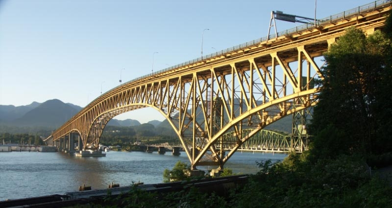
Ironworkers Memorial Second Narrows Crossing Collapse of 1958

 https://en.wikipedia.org/wiki/Ironworkers_Memorial_Second_Narrows_Crossing#Collapse 

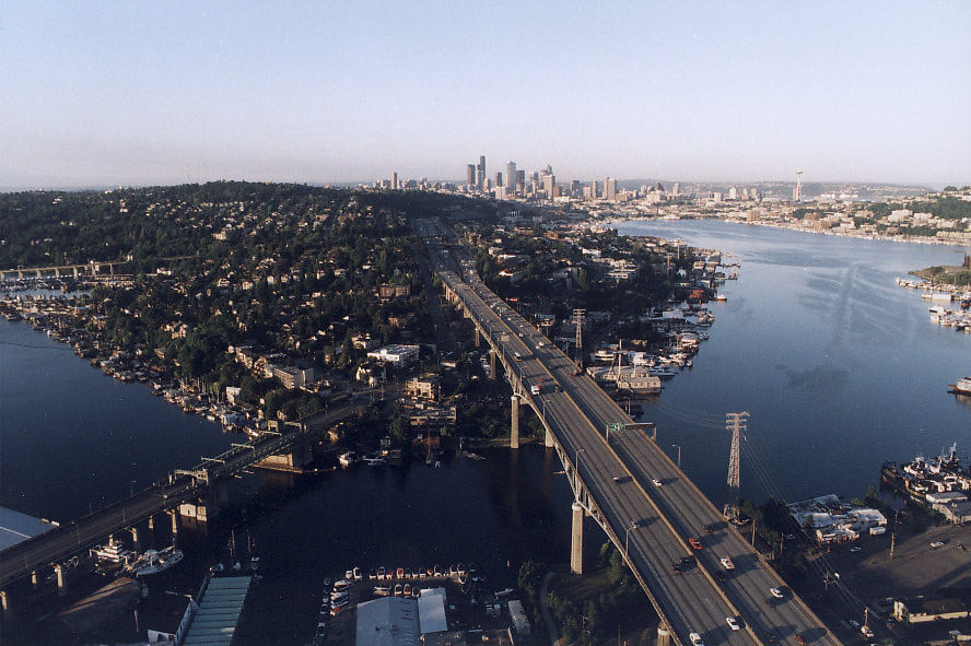
After the collapse, there was a chance that the Iron_Bridge (IwB) could have been totally redesigned, but this is BC. Its very difficult in BC to design transportation infrastructure with significant future capacity. The Iron Bridge should have been built along the lines of the 12 lane Ship_Canal_Bridge (SCB) in Seattle. https://en.wikipedia.org/wiki/Ship_Canal_Bridge 

Unlike Seattle and Washington State, so much in BC is built to a provincial backwater standard. Thus, nothing on the scale of the SCB has ever been allowed in BC. https://pauldorpat.com/2014/05/17/seattle-now-then-the-ship-canal-bridge Sunce an LRT line wasn't possible for the SCB, it runs sort of parallel in a tunnel to the UW. Of course LRT to UBC is still an incomplete BC pipe dream.

The IwB should have had at least 8 lanes on an upper deck and 4 lanes on a lower deck for extra bus and truck lanes. There should have also been a provision for 2 LRT tracks on a lower deck, but that would be properly planning for the future. 

Unfortunately, the Vancouver Mind Virus (VMV) ruined the Burrard-Bridge. The Burrard_Street Bridge (BSB) opened with 6 lanes and a lower level provision for a double track streetcar crossing.

https://www.vancouverisawesome.com/local-news/5-things-you-probably-didnt-know-about-the-burrard-bridge-7129420 

Foolishly, because the city didn't want to build a parallel bike bridge, 2 lanes were removed from the BSB. This has made it very unlikely that the BSB will be able to have 2 bus lanes. No lower level streetcar crossing was ever built. Yet, a streetcar line on both side of False Creek could have been a nice thing to have up and running. Ironically, Vancouver was one of the first cities to get rid of its streetcars and will likely be one of the last to bring them back. The VMV is such a horrible thing, yet it officially doesn't exist. 


https://jfdatalinks.blogspot.com/search?q=Second+Narrows+Bridge

Sunday, May 31, 2026

Honolulu and San Diego...

Honolulu is very reluctant to allow buildings to go much higher than 450 feet. SD can't go higher than 500 feet, because of the airport being so close. However, that's not the case in Boston.

https://en.wikipedia.org/wiki/Honolulu#Economy

https://skyscraperpage.com/diagrams/?cityID=421 

Will Honolulu ever have some Miami or Singapore size buildings? That remains to be seen. For now, Honolulu like San_Diego will remain free of 50 story hotels and condos and 40 story office towers. 

https://en.wikipedia.org/wiki/List_of_tallest_buildings_in_San_Diego

https://skyscraperpage.com/diagrams/?cityID=120 

If SD can ever relocate its airport, then it can have much taller buildings. Once Edmonton closed an airport that was too close to its downtown, the city eventually had the tallest building in Western Canada. 

Honolulu got a nice airport train station long before SD.

https://www.sandiegouniontribune.com/2024/09/05/will-san-diegos-airport-ever-get-a-light-rail-connection/

Friday, May 1, 2026

Should the Vancouver Whitecaps revive the Gastown waterfront stadium concept instead of pursuing Hastings Racecourse?

https://dailyhive.com/vancouver/vancouver-whitecaps-gastown-railyard-waterfront-stadium 

https://www.cbc.ca/news/canada/british-columbia/mls-commissioner-vancouver-whitecaps-new-stadium-1.7594905

https://www.facebook.com/groups/831329483640398/posts/25294271920252814/ 

https://theprovince.com/sports/soccer/mls/vancouver-whitecaps/mls-misrepresenting-whitecaps-stadium-availability-bc-place


https://en.wikipedia.org/wiki/Wellington_Regional_Stadium  "It was built on reclaimed railway land..." 

https://upload.wikimedia.org/wikipedia/commons/thumb/4/4c/CentrePort_and_Westpac_Stadium%2C_Wellington_NZ.jpg/960px-CentrePort_and_Westpac_Stadium%2C_Wellington_NZ.jpg 

These were both possible, because they are far away from any influence from the Vancouver Mind Virus (VMV).

https://en.wikipedia.org/wiki/Cape_Town_Stadium 

https://upload.wikimedia.org/wikipedia/en/thumb/9/9c/Capetown_stadium.JPG/960px-Capetown_stadium.JPG 


Despite Lumen_Field in Seattle being relatively close to BC, no VMV has seemed to have reached there.  

Unlike with BC_Place Stadium, Lumen_Field works well for soccer and American Football arrangements.

https://en.wikipedia.org/wiki/Lumen_Field#Soccer 

https://upload.wikimedia.org/wikipedia/commons/thumb/8/8a/Aerial_of_Qwest_Field_and_downtown_skyline%2C_2002.jpg/960px-Aerial_of_Qwest_Field_and_downtown_skyline%2C_2002.jpg

Accomplishing things in stubborn Vancouver, BC is just more difficult than in many other cities around the world.

=======================================

Could Honolulu Develop Like Tokyo or HK?  https://www.youtube.com/watch?v=pxkjJ2TNkY4 

No way. First, H. County would have to allow Singapore size buildings and infrastructure. Then, HK size stuff, before even getting close to something like a little Tokyo. Right now, H. isn't even allowed to have buildings as tall as what San Diego has. 

Monday, April 27, 2026

Old Pattullo Bridge and its Still Narrow Replacement

 https://www.youtube.com/watch?v=8_mNfn4zjcI 

Even in the 1930s there should have been some type of a big city vision, but with NW being so small and Surrey being so out of the way, this part of BC was on the urban periphery. Apparently, there was no concept of an emergency lane on the Pattullo Bridge. Still, in addition to the 2 narrow lanes each way, there should have been 2 lane for horses and wagons. Then, by the 1950s the PB could have had 3 wide lanes each way, pulse a strong traffic divider. Instead, the narrow PB was stuck with only two lanes each way, no safety divider and only 1 narrow sidewalk.

For most of its history, NW just saw it self as a provincial backwater. The lack of a big city vision in the early 1900s meant that it never bothered to absorb what would become the Tri-Cities. For most of its history, Surrey never considered that it could eventually become the largest city in BC. Of course now that has changed.

Despite being so small, NW has become a Metro Vancouver regional transit hub, because of the New_Westminster_station

Scott_Road_station is a transit hub for the South_Westminster area.

Surrey and NW really should have had a proper big city size bridge.

This is how the new road configuration could have gone for what should have been a 10 lane bridge, not another 4 lane BC joke. Even if it can eventually have 6 lanes, there is no provision for a lower deck for trains and busses.

This shows how existing key roads could have linked into a 10 lane bridge, all without having to widen the surrounding roads. Thus, no need for any major land expropriation.

2 lanes from Royal Avenue onto the new bridge and 2 lanes from the bridge onto Royal Avenue in New+Westminster.   

One lane onto and one lane off linking the bridge to the South_Fraser_Perimeter_Road in Surrey.

2 lanes onto McBride boulevard and 2 lanes onto the bridge from McBride in New+Westminster.  

From Columbia_Street_in New_Westminster, 1 lane onto the bridge, as well as 1 lane off the bridge

2 lanes from King_George_Boulevard onto the new bridge and 2 lanes from the bridge onto KGB in Surrey

2 lanes from Scott Road onto the new bridge and 2 lanes from the bridge onto Scott_Rd in Surrey.  

Things weren't properly explained to the public as to how important a wide big city bridge could have been possible and without having to widen the roads connecting to it.

Unfortunately, all of this is being funneled into just 2 lanes each way. Its as if someone symbolically wanted the new bridge to open without any bus and HOV lanes. That's how BC bottleneck and chokepoint planning works. 


https://en.wikipedia.org/wiki/Metro_Vancouver_Regional_District  

https://en.wikipedia.org/wiki/Fraser_Valley

Some day, the BC Lower_Mainland should be planned and developed to function more like a proper big urban area. 


https://jfdatalinks.blogspot.com/search?q=Pattullo+Bridge+replacement

Saturday, March 7, 2026

Burrard Street Bridge closes for Sen̓áḵw crane removal

 https://www.ctvnews.ca/vancouver/article/burrard-street-bridge-closes-for-senakw-crane-removal 

Several cities have parallel bike bridges, then the city planners don't have to remove traffic lanes. 

https://vancouversun.com/news/vancouver-burrard-street-bridge-temporarily-closure 

Unfortunately, the Burrard_St. Bridge (BSB) was hit hard by the multigenerational Vancouver Mind Virus (VMV). The Burrard_Bridge was designed to have a lower level for streetcars or tram-trains, but the city never followed through. Fortunately, the VMV was unable to stop Portland and Seattle from reviving some of their streetcar lines.  

The Burrard_Street_Bridge used to have 6 lanes and 2 wide sidewalks. However, since the city has a problem of not building separate bike bridges, 2 potential bus lanes were removed from the Burrard_Bridge. Now, if the city ever wants to have 2 dedicated bus lanes, the BB will only have 1 general lane each way. That's the VMV at work.

https://en.wikipedia.org/wiki/Burrard_Bridge#History

Tuesday, February 24, 2026

Delays out of North Shore continue after truck stalls for hour on Lions Gate Bridge

 https://vancouver.citynews.ca/2026/02/24/stall-on-lions-gate-bridge-causing-massive-delays-out-of-north-shore/ 

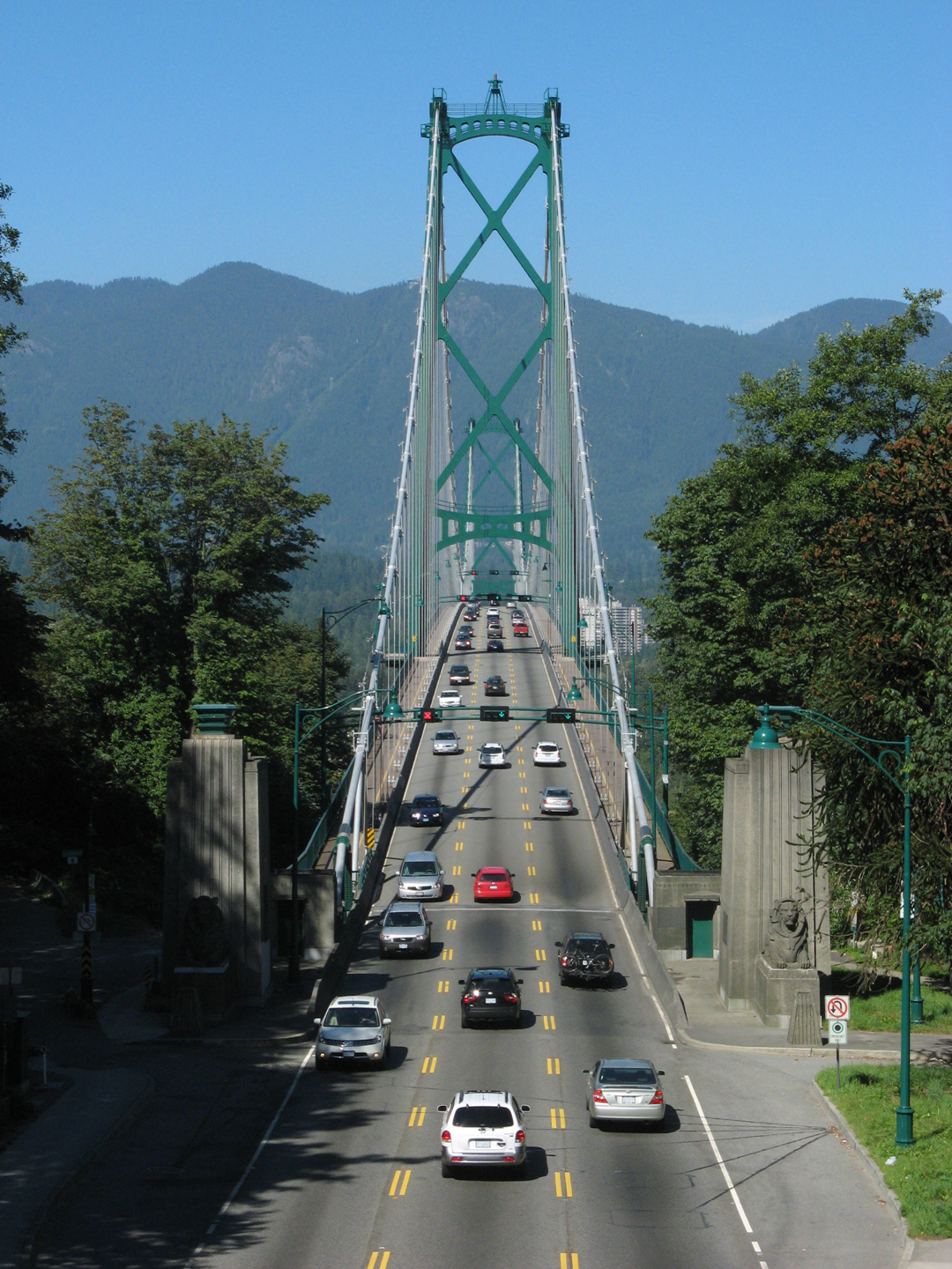
The LGB bottleneck is indicative of how some people don't want Vancouver to become a properly planned functioning big city.

https://www.reddit.com/r/vancouver/comments/1mehud6/theres_a_single_car_stopped_in_the_only/

Unfortunately, Vancouver still isn't allowed to function like a real proper big city. For several decades, so many key people, especially urban planners don't want to have a wider structural crossing to at least match what Prince George and Kamloops have. Or, to match what Kelowna has and especially don't want to have what Ft. McMurray has. 

Indeed, most proper major cities by now would have had a 6-8 lane tunnel right under the park and close to the LGB. Georgia Street is already 7 lanes wide in the first few blocks closest to the park, so the potential for a 7-8 lane tunnel should be possible.

An 8 lane tunnel would be best in that the 3 & 4 lane counterflow on Georgia could easily feed into an 8 lane tunnel. Then once in the tunnel there world be 3 standard lanes each way, plus a bus lane each way. 

A commuter train tunnel or an extension of the YVR-Canada Line should also run close to where the LGB is. Unfortunately, some key people for several decades don't seem to want or understand the benefits of having a train connecting YVR with both of the regional BC-Ferries terminals. That's because it could actually help to relieve transportation congestion. https://www.bcferries.com/current-conditions/TSA-SWB 

At least by now, there should have been a 2 lane BRT tunnel and a 2 lane truck tunnel, as well as at least a provision for a 2 track LRT tunnel beside that very narrow bridge. 

It's always amazing to see what other cities around the world can do, simply because they aren't trapped within the backwards Vancouver mindset or don't have a backwater BC mentality to thwart them. 

https://www.th.gov.bc.ca/atis/lgcws/index.html 

This has to be one of the worlds best examples of bottleneck-chokepoint planning around. 

https://www.translink.ca/schedules-and-maps/skytrain A rail rapid transit connection to both ferry terminals and YVR would be a huge improvement, but it's still not likely in the foreseeable future. 


https://jfdatalinks.blogspot.com/search?q=Lions+Gate+Bridge

Friday, December 26, 2025

Would people pay a bridge toll if it helps solve traffic woes on the North Shore?

 https://www.nsnews.com/opinion/letter-i-would-gladly-pay-a-bridge-toll-if-it-helps-solve-our-traffic-woes-11665442 

https://en.wikipedia.org/wiki/North_Shore_(Greater_Vancouver) 

As of 2026, no bus, car, truck and commuter train tunnel was ever built near the extremely inadequate 3 lane Lions+Gate+Bridge. For if there had then, the LGB could have become a nice bike and foot crossing.

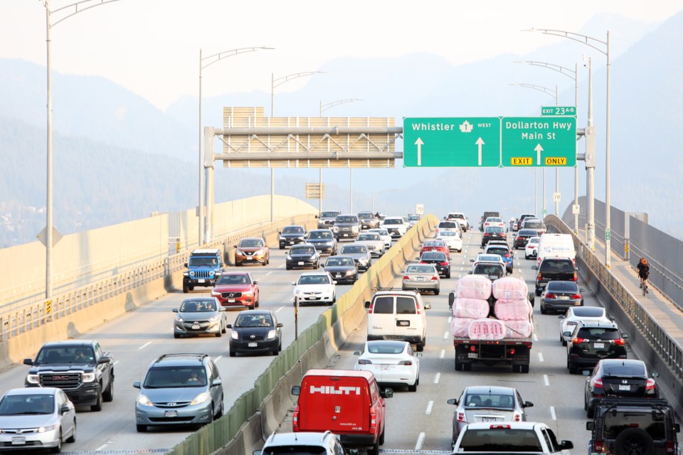
Of course no bus, truck and commuter train bridge was built next to the Iron+Bridge. The inadequate Iron Bridge is so narrow that there isn't any room for emergency lanes and especially no proper express or rapid bus lanes.

By now, there should be a SeaBus crossing of at least every 5 minutes in both directions. 

Its extremely difficult to bring the Greater Vancouver Region up to a proper urban transportation standard. Partly because this is part of backwards BC and partly because there is just such a lack of a normal big city vision. 

For some reason, congestive transportation planning just isn't that popular outside of backwards Vancouver, BC.

Sunday, October 26, 2025

All cables and final steel girders now installed for the Pattullo Bridge replacement

 https://dailyhive.com/vancouver/pattullo-bridge-construction-milestone-cables-deck Unlike the old, inadequate bridge, which only has 4 narrow lanes and just 1 sidewalk, this will have 2 sidewalks and 2 bike lanes. Unfortunatly, there won't be any bus or HOV lanes. Thus, all the traffic will be funneled into just 2 lanes each way. Of course there won't be any emergency lanes or breakdown lanes, so this is another quintessential BC bottleneck by design. At least a provision for a lower deck would have provided some hope. While this bridge can eventually be widened to 6 lanes, there seems to be no serious consideration for there to be bus and HOV lanes. So it will end up like the overloaded 6 lane Iron Bridge.

https://en.wikipedia.org/wiki/SkyBridge_(TransLink) No bike lanes and sidewalks and it wasn't built wide enough to eventually accomodate 3-4 tracks and 2 bus lanes. There is just something about backwards BC that makes it so obtuse and inept. 

https://upload.wikimedia.org/wikipedia/commons/thumb/1/1d/SkyBridge_from_SkyTrain_%285770458210%29.jpg/500px-SkyBridge_from_SkyTrain_%285770458210%29.jpg At the very least, this bridge should have had 3 tracks and 2 bus lanes, a bike lane and a sidewalk on a lower deck. There is only a middle service track and apparently, no provision for a bike lane and a sidewalk.

https://en.wikipedia.org/wiki/New_Westminster_Bridge Still, only a single track bridge for freight and passenger trains. 

https://upload.wikimedia.org/wikipedia/commons/thumb/1/1f/New_Westminster_Swing_Bridge.jpg/960px-New_Westminster_Swing_Bridge.jpg This old single track bridge should have been double tracked on a lower deck and have at least 4 lanes on an upper deck. Then when the first 4 lane Pattullo Bridge opened, it might not have been quite as overloaded in its later decades. 

In order for this joke of a river railway crossing to be properly upgraded and efficient is for there to be at least a new double track bridge.  

NW should have really had something like its own version of the Steel_Bridge in Portland. 

https://upload.wikimedia.org/wikipedia/commons/thumb/5/51/Amtrak_talgo_train_crossing_steel_bridge.jpg/960px-Amtrak_talgo_train_crossing_steel_bridge.jpg Fortunatly, Portland didn't have a provincial backwater mentality like NW. Thus, they could build a lot more bridges. 
https://upload.wikimedia.org/wikipedia/commons/thumb/8/80/SteelBridgePano1.jpg/960px-SteelBridgePano1.jpg MAX light rail on the upper deck and Amtrack and freight trains on the lower deck. Fortunately, Oregon is far enough away from ever catching the BC Mind Virus. 
https://upload.wikimedia.org/wikipedia/commons/thumb/e/e3/Aerial_view_of_Willamette_River_crossings_in_Portland%2C_February_2018.JPG So many nice bridges in Portland. 
 
There is such a the lack of bridges between NW and Surrey.
https://upload.wikimedia.org/wikipedia/commons/thumb/0/0a/New_Westminster_Aerial_view_2015.jpg/960px-New_Westminster_Aerial_view_2015.jpg For most of the history of NW, Surrey was just some farmland south of the river with not much going on, but its many times larger than little NW. 

There just didn't seem to be that much a big city vision for little provincial backwater NW. Back in the day, NW could have acquired what would become the Tri-Cities and perhaps, even Surrey. There just wasn't any desire to have a big river city in BC on the scale of Portland,_Oregon. So while NW is stuck as a tiny city, Surrey is on its way to becoming the biggest city in BC.

Unfortunately, the Iron Bridge and Granville Bridge were never designed to have a lower deck for trains and buses either. That's just how it is in backwards BC.  


Tuesday, October 14, 2025

Granville Bridge, Vancouver, etc.

 https://vancouver.ca/streets-transportation/granville-bridge.aspx 

Even after 3 tries, Vancouver still couldn't quite get the Granville_Street_Bridge (GSB) correct. Of course the 3rd bridge wasn't designed to have a lower deck for streetcars or tram-trains. Even though it was generally designed to be a car, truck and bus bridge, the sidewalks should have been double width and have an inner railing. If the city couldn't wait until late March, it should have had the official dedication in early March, not in crappy February 1954.

https://en.wikipedia.org/wiki/Granville_Street_Bridge#Third_bridge_(1954) "On February 4, 1954, the current Granville Street Bridge opened to traffic after five years of planning and construction; its dedication ceremony was attended by 5,000 spectators after it had been delayed a week due to heavy snow." 

https://en.wikipedia.org/wiki/Granville_Street_Bridge#21st_century Unfortunatly, new bike lanes and extra sidewalks couldn't be installed below the 8 lane deck. Thus, Vancouver went for strike 3 and removed 2 lanes from the bridge. The Burrard+Street+Bridge lost 2 lanes and the Cambie+Bridge lost 1 lane. A bike and foot bridge could have been built on the west side of the Burrard Bridge, then no lanes would have been removed. The Cambie Bridge already had a wide sidewalk on its east side. The west sidewalk should have been widened, then no lane would have been removed. 

The Granville+Bridge could have had 6 lanes and 2 bus lanes. Now, if there are ever 2 bus lanes, there will only be 2 general lanes each way.

Several cities around the world have bike & foot bridges and don't have to remove lanes from the existing bridges.

For such a congested city to have removed 5 lanes from 3 bridges, could there even be more of a reduction of lanes Well, there are some who would like to have the LGB just for bike and foot traffic.

https://globalnews.ca/news/1946543/government-says-lions-gate-bridge-will-not-close-to-cars-come-2030 

That would be OK if an 8 lane tunnel could be built near it. Such a First Narrows Tunnel could have 3 lanes each way, plus a bus lane each way. A parallel triple track commuter train tunnel should be built close to it as well.

The new & improved tunnel between Richmond and Delta won't be ready until 2030. Since things move so slow in constipated, backwards BC, perhaps a First_Narrows_Tunnel might not be completed until 2040, or even 2050.


https://jfdatalinks.blogspot.com/search?q=Granville+Bridge

Monday, October 13, 2025

Majority polled in Calgary and Edmonton are unhappy with the pace of population growth

 https://www.cbc.ca/news/canada/calgary/too-much-too-fast-majority-polled-in-calgary-edmonton-unhappy-with-pace-of-population-growth-9.6935121 

If you are visiting Vancouver or Victoria from Calgary or Edmonton, you will be shocked as to how narrow most of the bridges are in Greater Vancouver and Victoria. Edmonton was wise in the 1970s to have 125 m long underground LRT stations. Foolish Vancouver opted to only have 80 m stations on its first 2 lines and an absurd 50 m for the 3rd line. 

https://en.wikipedia.org/wiki/Green_Line_(Calgary) , https://www.calgary.ca/green-line.html 

https://www.calgarytransit.com/plans---projects/lrt/green-line.html

https://engage.calgary.ca/greenline/UndergroundStations Fortunatly, any underground stations in Calgary will be closer in length to that of the Edmonton LRT and not backwards Vancouver.

https://www.railjournal.com/regions/north-america/tunnel-preferred-for-calgary-lrt-green-line/

https://www.tunnelsandtunnelling.com/news/calgary-city-council-approves-green-line-lrt-construction/?cf-view

https://www.calgary.ca/green-line/stations.html

https://www.tunnelsandtunnelling.com/news/calgary-city-council-approves-green-line-lrt-construction/?cf-view 

The main roads and bridges in urban parts of Alberta are allowed to be wider than their counterparts in backwards BC. So while people in the urban parts of Alberta are concerned or even angry about rapid growth, at least Alberta can easily build more urban infrastructure. That's because Albertal isn't affect by the (unofficial) BC Mind Virus (BCMV). 

A timely example is a new bridge between Surrey & NW. Despite Surrey being expected to become the largest city in BC, the new bridge will only open with 4 lanes. No 3rd or 4th lane each way for busses, HOVs and trucks. Thus, all the road traffic at either end is funneled into just 2 lanes each way. Plus, there are no breakdown or emergency lane, just like the old bridge.   

While this new bridge can eventually be widened to 6 lanes, there is no provision for a lower deck for LRT, busses and trucks. Despite SW BC being a seaport area, trucks are funneled onto mostly narrow bridges. There has been a lack of interest to build bus bridges next to almost all of the bridges in Greater Vancouver. Yet, there is a Half-A$$ED attempt to have a better regional express bus network. This regional Rapid Bus attempt will always be a joke, unless a series of bus bridges are built. The Half-A$$ED approach is to try to have bus lanes on 4 to 6 lane bridges. Designating 2 bus lanes would reduce the narrow bridges to only 1 or 2 lanes each way for general traffic in what is suppose to be a major seaport and urban area.   

Most of the worlds population is non-white and for a big part of the history of BC, there has been a refusal to build up bigtime infrastructure for everyone. While some Albertains might wish that there was a wall built around their province or a force-field like out of Star Trek, BC is almost pretending like there is. Thus, the keep things small and backwards mentality. 

Several decades ago, BC implemented a symbolic slow-growth approach. Despite BC not having any control over immigration, or trying to establish an internal passport & checkpoint system, to KEEP PEOPLE OUT, it opted for the next best thing. Stunt or scale back the urban infrastructure to project a strong symbolic reluctance to growth and thinking big. 

When you realize how much larger things are allowed to be in Alberta, Washington State and even Western Australia & compare them to watered down BC, you see quite a difference. Despite BC & Canada in general, being multicultural, BCs cities keep finding ways to water the scale of things down. Canada has yet to have even 1% of the world's population, despite its size.  

While there are good arguments to occasionally slowdown immigration, that can eventually become problematic, just like too much immigration. Even in the 2020s, some people in the former White colonial parts of the world still wish that Canada & Australia, etc., could be a White Man's paradise. However, that seems so impractical on a planet that mostly has a non white population. 

https://humanrights.ca/story/chinese-head-tax-and-chinese-exclusion-act

https://thecanadianencyclopedia.ca/en/article/chinese-head-tax-in-canada 

https://royalalbertamuseum.ca/blog/chinese-head-tax-george-yees-story 

https://www.musee-mccord-stewart.ca/en/blog/chinese-exclusion-act/

https://parks.canada.ca/culture/designation/evenement-event/exclusion-chinois-chinese

https://www.canada.ca/en/canadian-heritage/campaigns/asian-heritage-month/important-events.html

https://stanleyparkvan.com/stanley-park-van-monument-komagata-maru.html

https://vancouver.citynews.ca/2022/10/05/vancouver-komagata-maru-memorial

https://vancouver.citynews.ca/2023/01/30/vancouver-komagata-maru-memorial-vandalism/

Even if Alberta were to eventually become its own country, it would be extremely unlikely that it could ever impose a White Man's Paradise Agenda. The same could be stated for backwards BC. However, something very peculiar has been happening in BC for several generations. 

Several BC cities and municipalities play off each other with various slow-growth agendas. Vancouver being one of the most restrictive & backwards on the the planet. Somehow the legitimate anti freeway fears of the 1960s & 70s didn't get the city & region to still build a series of bus & HOV bridges. Plus, a long-term, high capacity urban rail system.

While Montreal planned for 152.4 m stations to accomodate 9 car trains, backwards Vancouver only built 80 m Skytrain stations for the first 2 lines. Then to top that, was a plan to build a line to Richmond with only enough level clearance for 50 m stations. The 1st line only started to run 5 car trains in 2025. Eventually, the 2nd line will also have 5 car trains. However, the line to the airport was deliberately designed not to have 5 car trains. Just a Half-A$$ED 2.5 car train, someday. WTH?

For Greater Vancouver to mostly have narrow bridges, one would think the all the stations could ultimately be at least as long as a Montreal Metro train station. Indeed, Greater Vancouver should have built for 10 car trains, but will only have 5 car trains on the 1st  two lines & a 2.5 car joke of a train on the 3rd line. As of 2025, the 2nd & 3rd lines are still only running 2 car trains. Such a great way to symbolically show the resistance to eventually link YVR to both of the main BC ferry terminals. 

The inadequate 3 lane Lion Bridge still has no bus & HOV tunnels near it. Urban parts of Australia never seemed to have a similar reluctance to build tunnels as does backwards Vancouver. Tunnels for Montreal & Seattle aren't a problem either. At least BC is slated to have a new and improved tunnel by 2030, that's only a couple of generations late.   

Oh, if only people would stop moving to BC, especially Vancouver & Victoria. Well, that's not the case, its just that various BC cities want to only build urban infrastructure that is inadequate. Despite the frustrations that some people have in Alberta, at lest wider bridges, longer trains & taller buildings are allowed there. This watering things down in BC approach is symbolically indicative to refuse to properly build for a growing population. 

Surrey should have already had at least 1 hospital the size of VGH. At least Surrey like Burnaby, can build up taller in what is still mostly a mountain wilderness province. 

BC is a long way from New England & Southern Quebec. The restrictive urban planning measures in Greater Vancouver keep preventing it from becoming a proper big metropolitan area like Greater Boston and Montreal. 

Calgary and Edmonton each should have hand an airport+line by now.

https://en.wikipedia.org/wiki/Green_Line_(MBTA) Calgary will have its own version of a Green Line, eventually. https://jfdatalinks.blogspot.com/search?q=Calgary+Green+Line

Wednesday, August 20, 2025

Pacific National Exhibition (PNE)

The Pacific_National_Exhibition, which is in Hastings+Park, should have been much bigger and better by now, but this is watered down Vancouver. https://www.pne.ca/hastings-park-access , https://en.wikipedia.org/wiki/Hastings_Park

https://thecanadianencyclopedia.ca/en/article/pacific-national-exhibition-pne

https://www.pne.ca/about-us/history-legacy 

Generations ago, one could take a streetcar to the PNE. Of course it's still possible at the CNE.

https://vancouversun.com/news/this-week-in-history-1890-vancouver-gets-cutting-edge-with-an-electric-streetcar-and-light-system 

https://montecristomagazine.com/community/vancouvers-forgotten-streetcars#gsc.tab=0

https://kumtuks.ca/streetcars-and-metro-vancouver/

https://macleans.ca/culture/i-started-working-at-the-pacific-national-exhibition-when-i-was-12-it-was-a-wild-ride/

https://www.vancouverisawesome.com/history/brief-history-of-pne-playland-1935285 

https://dailyhive.com/vancouver/pne-history-photos-vancouver  

https://604now.com/history-pne-vancouver-bc/ 

https://www.ctvnews.ca/vancouver/article/heres-how-many-people-attended-the-pne-this-year (2024)

https://vancouversun.com/news/pne-draws-nearly-638000-people-the-highest-since-the-pandemic

https://dailyhive.com/vancouver/pne-fair-attendance-2024

https://www.chronicallyvintage.com/2014/08/a-vintage-photo-filled-look-at-history.html

https://evelazarus.com/the-pne-then-and-now 

https://www.echostories.com/backstory/pne-anniversary-book/


Unfortunatly, it hasn't always been a fun place.

https://hastingspark1942.ca/

https://hastingspark1942.ca/buildings-overview/

https://hastingspark1942.ca/history/momiji-gardens/


https://jfdatalinks.blogspot.com/search?q=PNE 

https://jfdatalinks.blogspot.com/search?q=Hastings+Community+Park+and+Hastings+Park

Friday, July 25, 2025

Granville Bridge's new wide, safe pathways for walking and cycling now open

 https://dailyhive.com/vancouver/granville-connector-bridge-walking-cycling-pathways-open-complete

Its OK, but it could have been better.

Had there been a nice bike & foot bridge built next to it, the Granville Bridge could have had 3 general lanes each way & the 4th as a bus lane. Just like the Burrard Bridge should have had a bike & foot bridge next to it. Then, the BB could have had 2 bus lanes as well as 4 general lanes. Taking lanes away is absurd for a city that already has such a narrow road system. Yet, a proper regional bus & bike bridge system wasn't implemented.

It seems that the public wasn't properly informed decades ago that Greater Vancouver wasn't going to have a 24hr train system. All the more important for the GV Region to have a network of bus & bike bridges. Several the regional bridges are so narrow that there isn't enough room to accommodate 2 bus lanes & 2 HOV lanes.


https://jfdatalinks.blogspot.com/search?q=Granville+Bridge

Friday, July 11, 2025

How Bike Lanes have affected Vancouver's urban infrastructure

https://www.youtube.com/watch?v=LvkifuIjq9I The BSB was a 6 lane crossing that even had a provision for a lower deck intended for streetcars. Eventually, 2 lanes were removed & the lower deck was never completed. However, Vancouver was unable to prevent Seattle & Portland from reviving some of their streetcar routes.

The problem isn't bike lanes, it's the lack of interest to build a proper regional network of bus & bike bridges. Thus, if a proper bike bridge was built next to the Burrard+Street+Bridge, then 2 of its 6 lanes could have been for buses or at least HOV lanes. The lower deck could have still been for streetcars or tram-trains going between Vancouver & Richmond. The irony of backwards Vancouver is that it was one of the first cities to get rid of its streetcars & will likely be one of the last to bring them back.

The Fraser River Tunnel Project https://www.youtube.com/watch?v=NWhHJWKa6CQ Unfortunatly, this will still be a chokepoint or congested crossing.

Of course the new Richmond-Delta+Tunnel wasn't designed to be part of a rail link between the airport and the ferry terminal. There should have been 2 HOV lanes, as well as 2 bus lanes, but that would be a big-city 10 lane crossing. Instead, just an 8 lane tunnel with no train component. Eventually, a train and HOV bridge or tunnel will have to be built next to it. 

At least the first SkyTrain line can now have 5 car trains. However, the 2 car joke of a train still exists between Vancouver & Coquitlam, as well as between Vancouver & Richmond. The Montreal Metro can have 9 car trains and BART in SF can have 10 car trains. Such things are possible because they don't have a congestive BC panning mentality.


https://jfdatalinks.blogspot.com/search?q=Bike+Lanes

Thursday, April 24, 2025

The Canada (embarrassment) Line

Using the limited funds and low capacity argument is excrement! It's only because of inept urban planning that the Canada+Line is such a transportation embarrassment & sad joke since 2009. Several other cities around the world are able to think big, they plan & build in a long-term way. Thus, if there are only enough funds to build a 2.5 car train, the stations could have been designed to eventually accomodate 5 car trains as demand increases. Plus, all the stations should have been designed with enough clearance to gradually be long enough for 10 car trains.

https://www.translink.ca/-/media/translink/documents/plans-and-projects/regional-transportation-strategy/transport-2050/backgrounders/transport_2050_backgrounder_action_2_rapid_transit_network.pdf

An ultimate capacity of 10 car trains connecting both ferry terminals with the airport & downtown Vancouver, would really have been properly planning for the future. 10 car trains running every 2 minutes during the busiest times of the day would efficiently allow a lot people to get around. Unfortunatly, it will be challenging enough just to eventually have 5 car trains.

https://dailyhive.com/vancouver/canada-line-skytrain

The absurdity to design the stations to only handle 2.5 car trains is a sad joke. The ultimate capacity of two 20m cars with a 10m filler car is so inadequate & pathetic, but this is the BC part of Canada. This backwards & backwater thinking must be challenged. 

https://dailyhive.com/vancouver/skytrain-future-station-locations

With some modifications, three 20m cars could form a 60m train, despite the absurd platforms only having a clearance for 50m. A 60m walkthrough train makes this possible, its just that the doors at either end wouldn't reach the short station platform. Selective_door_operation could enable the Canada Line to go from a 2 car & 2.5 car joke, to a 3 car & ultimately, a 5 car train. That's still a far cry from cities with 10 car trains running every 2 minutes. However, a 5 car train running every minute could make all the difference for Greater Vancouver.

https://www.cbc.ca/news/canada/british-columbia/what-you-need-to-know-north-shore-wastewater-treatment-plant-1.7235368# Aparently, there is enough money to overpay for a $HIT-PIPE and a $HIT-BOX, but not enough funds to build a proper high capacity train over a couple of decades.  

The Canada_Line opened in 2009 with its short 2 car trains & in 2025, there still aren't any 2.5 car trains. By now, it really should have been running 5 car trains, connecting the 2 ferry terminals & the airport. Fortunately, most real cities are able to do proper long range planning for their infrastructure, unlike backwards Vancouver.

https://en.wikipedia.org/wiki/SkyTrain_(Vancouver)_rolling_stock#Canada_Line_fleet 

Any serious airport+train should be envisioned as more than just a 2 car joke. While a 3 car train might be a little better, a 4 car train should be the minimum. Then, having the stations already long enough to accomodate 6 car trains, with enough clearance for eventually 8-10 car trains. A 2 car joke of a train is almost as bad as the 3 lane Lion Bridge. 

There should have been enough informed people to not only make sure that the C+Line was properly designed, but that the whole Greater Vancouver Region had proper planning measures for future transportation infrastructure capacity. Unfortunatly, backwards BC has been under a multi-generational backwater agenda. 


https://jfdatalinks.blogspot.com/search?q=Canada+Line 

https://jfdatalinks.blogspot.com/search?q=airport+line

Wednesday, April 23, 2025

Oakridge Park Mall and train station

 https://dailyhive.com/vancouver/oakridge-park-mall-free-parking-vancouver

https://en.wikipedia.org/wiki/Oakridge-41st_Avenue_station Each underground station could have been built with a future level clearance of 100 m and ultimately, 160 m. Unfortunately, in classic backwards Vancouver planning, the stations only have a level clearance of 50 m. Its as if there wasn't anyone interested in making sure that such transportation infrastructure could eventually have proper big-city size stations.

https://upload.wikimedia.org/wikipedia/commons/1/18/Oakridge%E2%80%9341st_Avenue_station_Platform_2018.jpg Its almost painful to see how small these stations are. The Montreal Metro stations are 152.5m or 500 feet long & can accommodate a 9 car train. All of the underground stations of the Canada (embarrassment) Line are only 40-50m. Anyone in engineering or construction knows, that if designed properly, a structure can eventually be lengthened or widened.

Therefore, all the stations should have been doubled in length by now to be 100m. Then in another decade the stations should have become 160m & in another decade, 200m. Unfortunately, the Canada Line was only designed to ultimately accommodate a 2.5 car train, not 8-10 car trains.

As of 2025, the 2009 Canada Line operators are still only running a 2 car joke of a train.


https://jfdatalinks.blogspot.com/search?q=Oakridge 

https://jfdatalinks.blogspot.com/search?q=Oakridge+Park+Mall

Saturday, April 19, 2025

The narrow bridges of Vancouver, Canada

https://montecristomagazine.com/community/forgotten-bridges-vancouver

The LGB just wasn't designed with any future capacity in mind. 

History of the Lions Gate Bridge https://www.youtube.com/watch?v=JHqi7Kijedw 

https://en.wikipedia.org/wiki/Lions_Gate_Bridge#History

https://upload.wikimedia.org/wikipedia/commons/7/7e/Lions_Gate.jpg 

The inadequate 3 lane LGB is currently the most narrow road bridge in backwards & stubborn Vancouver. It's been in that category since the removal of the 2 lane Fraser Street Bridge in the 1970s. There was a refusal to twin the absurdly narrow LGB between the 1950s & 1970s. By the 1980s there should have been a subway tunnel and an 8 lane tunnel. Then two of the lanes could have been for buses. Georgia+Street is 7 lanes wide as it gets closer to Stanley Park. Thus, the main part of a tunnel through the park could have provided 3 general lanes each way & a bus lane each way. Instead, the 7 lanes of the westernmost part of Georgia Street are funneled into a 3 lane causeway & a 3 lane bridge. The LGB would be fantastic as just a bike & foot crossing, with train, bus & road tunnels well beneath & beside it.    

The Burrard_Bridge, BB or  BSB opened with 6 lanes, but now it only has 4 lanes. There are 2 bike lanes & 2 sidewalks. Had a parallel bike-bridge been built, the BB could have still had 6 lanes. While the BB has a lower level provision for streetcars or tram-trains, Vancouver did its damndest to phase out streetcars well before the 1960s. 

The Ironworkers_Memorial_Bridge has 6 lanes, but should also have had 2 wide shoulders & 2 very wide sidewalks. Unfortunatly, there was no provision for a lower deck, as is also the case with all of the other Vancouver  bridges. https://en.wikipedia.org/wiki/Ironworkers_Memorial_Second_Narrows_Crossing

Any replacement of the inadequate Ironworkers+Memorial+Bridge should be on the scale of what Perth, Seattle and Montreal have done.

https://en.wikipedia.org/wiki/Granville_Street_Bridge#Third_bridge_(1954)

https://www.youtube.com/watch?app=desktop&v=vPSdF0jRTC4 The Granville-Bridge or GSB is the widest bridge in the city limits. It opened with 8 lanes, but is being transformed into a 6 lane bridge with 2 bike lanes & 2 sidewalks. Had there been a paralel bike & foot bride, the GSB could have still been 8 lanes wide. Then there could have been 2 exclusive bus lanes.

https://vancouver.ca/streets-transportation/granville-bridge-connector.aspx

The Oak Street Bridge should have been 8 lanes wide, with 2 wide sidewalks.

The Knight+Street+Bridge should have been 8 lanes with 2 wide sidewalks. Instead, its a 4 lane chokepoint.

The Arthur+Laing+Bridge should have been at least 6 lanes with 2 proper bike lanes & 2 sidewalks.

If the Cambie_Street_Bridge had 2 very wide sidewalks, then its likely that it would still have 6 lanes instead of 5. https://en.wikipedia.org/wiki/Cambie_Bridge#The_present_bridge

Unfortunatly, bottleneck or chokepoint planning is part of the Vancouver & BC mentality.

Of course BC & the Metro+Vancouver Region just hasn't put enough funds and effort towards proper big-city planning & infrastructure development. 

If Perth+and+Seattle had to conform to the extremely restrictive Vancouver approach to things, those cities would be in a perpetual state of chaos. Fortunately, nothing like the BC Mind Virus has ever reached WA.


https://jfdatalinks.blogspot.com/search?q=Lions+Gate+Bridge

https://jfdatalinks.blogspot.com/search?q=Oak+Street+and+Granville+Street 

https://jfdatalinks.blogspot.com/search?q=Oak+Street+Bridge OSB

Saturday, February 1, 2025

This Day in History 1960: Phil Gaglardi, a bulldozer and the Tsawwassen ferry terminal

B.C. Ferries was announced after the two privately owned ferries to Vancouver Island both went on strike https://vancouversun.com/news/this-day-in-history-1960-phil-gaglardi-tsawwassen-ferry-terminal?tbref=hp

Unfortunately, then & now, there still seems to be no plan to have a train from the Tsawwassen+ferry+terminal to YVR. Just like no train from the Horseshoe+Bay+ferry+terminal to YVR.  

Wednesday, January 15, 2025

Half of the new five-lane Steveston interchange on Highway 99 opens to traffic

 https://dailyhive.com/vancouver/new-steveston-interchange-highway-99-richmond-partial-opening

https://www.highway99tunnel.ca/project-overview/

https://www.highway99tunnel.ca/current-work/

https://www.highway99tunnel.ca/project-overview-frt/

https://www.rocktoroad.com/monumental-project/

https://www.delta-optimist.com/local-news/new-fraser-river-tunnel-will-have-a-new-name-when-it-opens-8512194

https://richmondsentinel.ca/article-detail/28157/history-of-the-massey-tunnel It's sad & pathetic that when the old tunnel was designed & then opened, there was no provision to have 3 lanes each way. Thus, despite being a seaport region, cars & trucks had to be funneled into just 2 lanes each way. It would have been too forward thinking to have the tunnel augmented by a couple of parallel bridges in the area.

Now once again, there still won't be another bridge or 2 in the area. A North and a South Boundary+Road Bridge could provide a vital link over the inlet and over the river. Then a Nelson Road Bridge to Delta and the Deltaport.  


https://jfdatalinks.blogspot.com/search?q=Richmond-Delta+Tunnel